📊 Trail Stats
- Distance: ~5 miles round trip
- Ascent/Descent: ~1,200 ft
- Total Time: ~5 hours
- Moving Time: ~2.5 hours
- Difficulty: Easy–Moderate
- Route Type: Out & Back
- Date Hiked: March 8, 2025
The first time we saw what locals call the “Tajik Sea” was on our way to the Pamirs in October of 2024.
You come out of the long tunnel and everything feels tight for a moment—the mountains pressing in close on either side of the road—before the valley suddenly opens back up again as you pass the entrance gate into Nurek. A few turns later, you roll past the statue of the pomegranates and cut across the bridge.
And then it’s there.
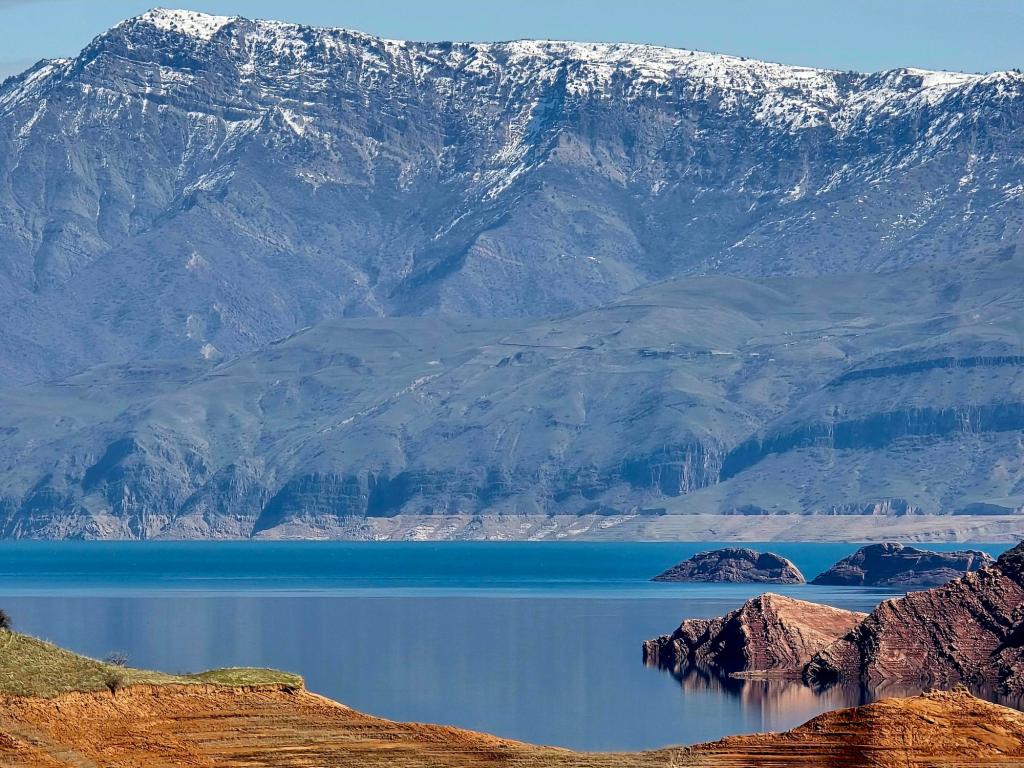
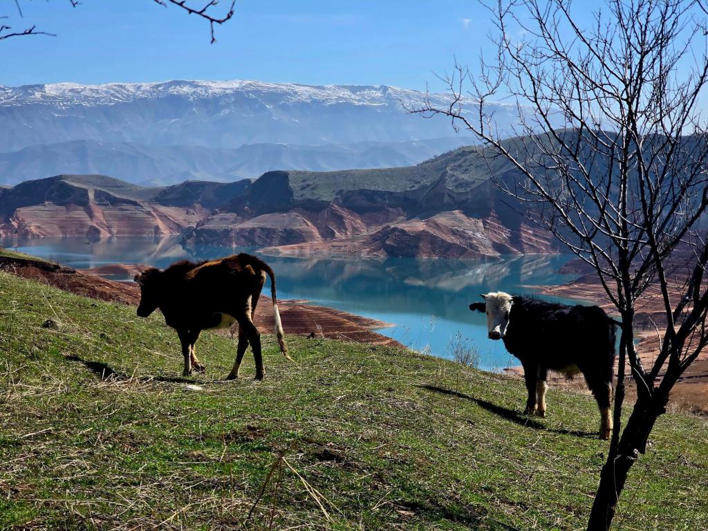
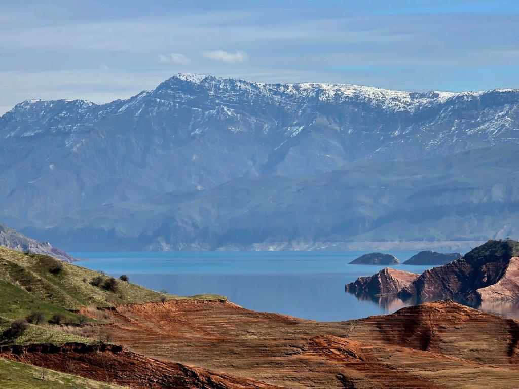
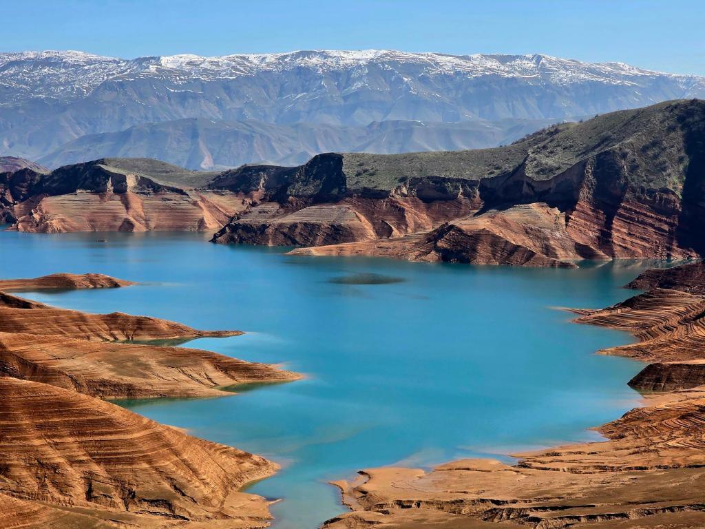
Off to the left, the water appears almost out of nowhere. A deep, almost unreal turquoise, stretching for miles along the base of dry, rugged mountains. It doesn’t look like something that belongs here. Not in this landscape. Not tucked into this valley.
You start climbing immediately on the far side, the road pulling you higher and higher above the shoreline. The views open with every turn until you reach that long stretch of fruit and vegetable stands perched high above the water—rows of tables loaded with pomegranates, melons, and whatever’s in season, all set against one of the best views in the country.
It’s the kind of place that makes you slow down, even if you weren’t planning to.
🧭 Quick Facts: The “Tajik Sea”
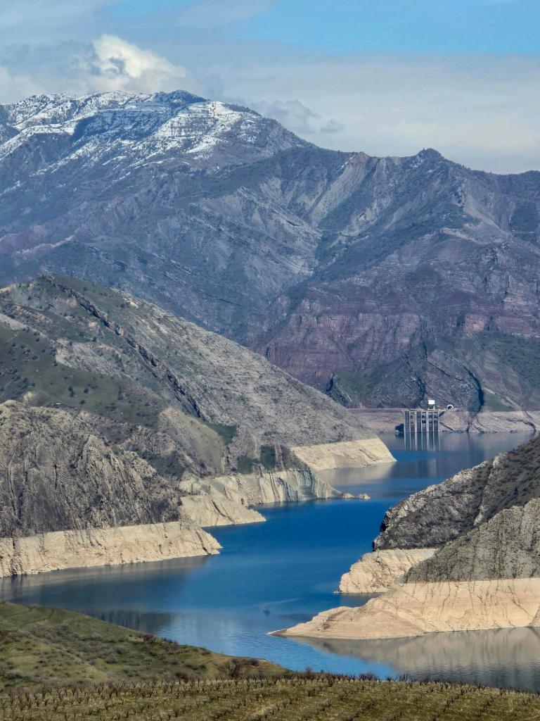
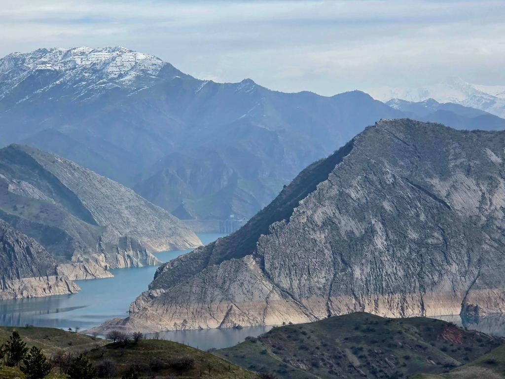
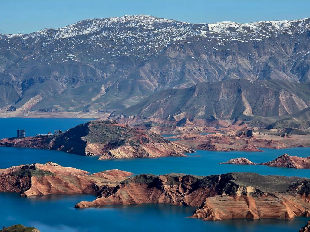
The reservoir you’re looking at is part of Nurek Reservoir, created by the massive Nurek Dam.
- Stretches roughly 70 km (43 miles) through the valley
- One of the largest reservoirs in Central Asia
- The dam rises over 300 meters, once the tallest in the world
- Produces a major share of Tajikistan’s electricity
What feels like a remote mountain landscape is actually shaped by one of the biggest engineering projects of the Soviet era.
It’s an excellent viewpoint, and most cars stop here—either to take in the views or stock up on fruit. During pomegranate season, vendors are pressing big cups of fresh juice for about 50 cents, and it’s hard to pass that up.
The photos I’m dropping into this post are from a return trip the following March.
We continued a couple of miles past the fruit stands before pulling off at a gated dirt road and parking the van. From there, we slipped through the small door built into the gate and started following the double-track down toward the water.
It’s an easy descent, the kind that lets you settle into a rhythm right away. The road winds steadily downward—dropping roughly 1,200 feet—cutting across dry hillsides and passing the crumbling mud foundations of what were once small buildings. Out here, it’s hard to tell if those places were abandoned five years ago or fifty. Time doesn’t leave clear markers in this landscape.
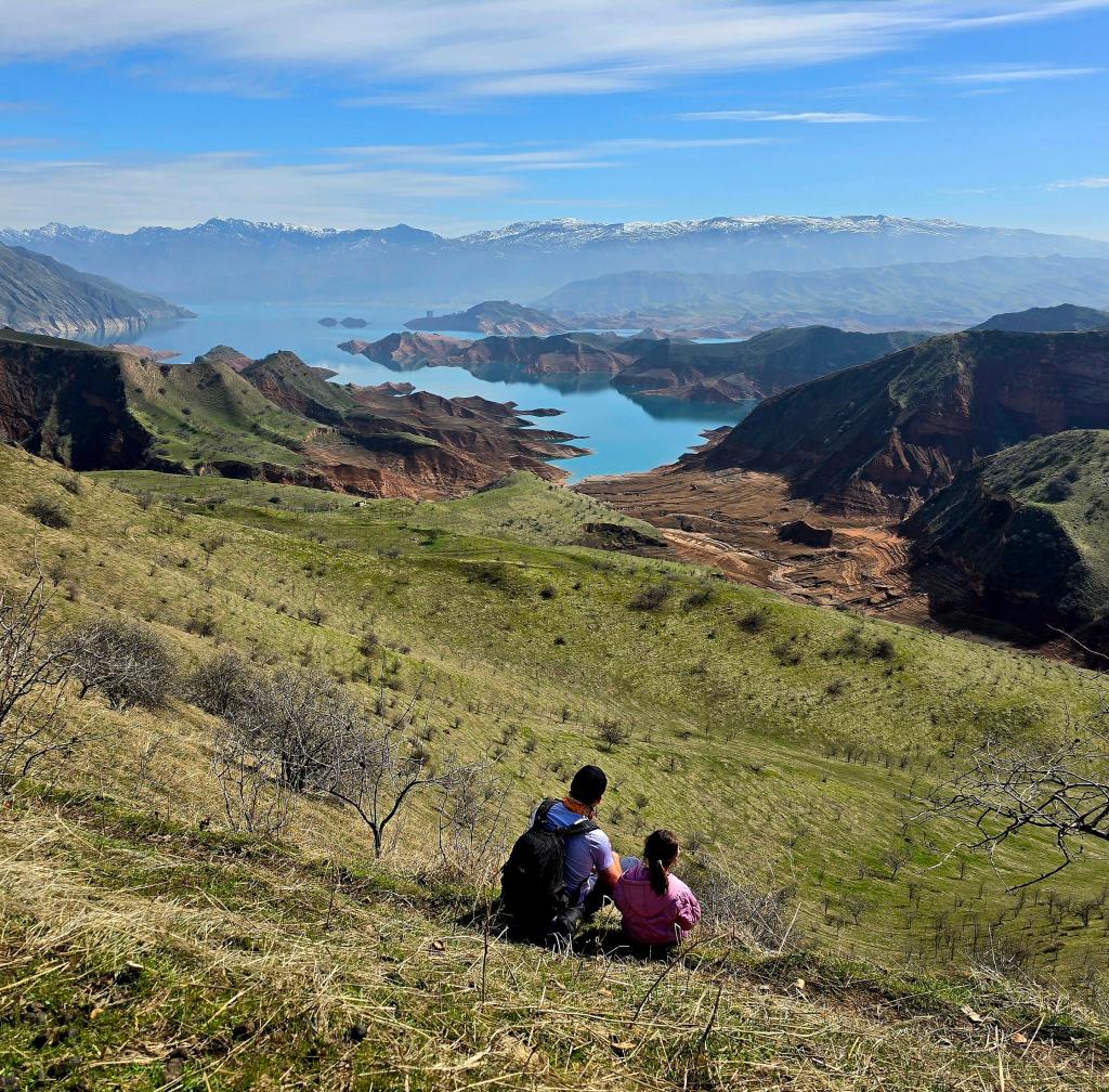
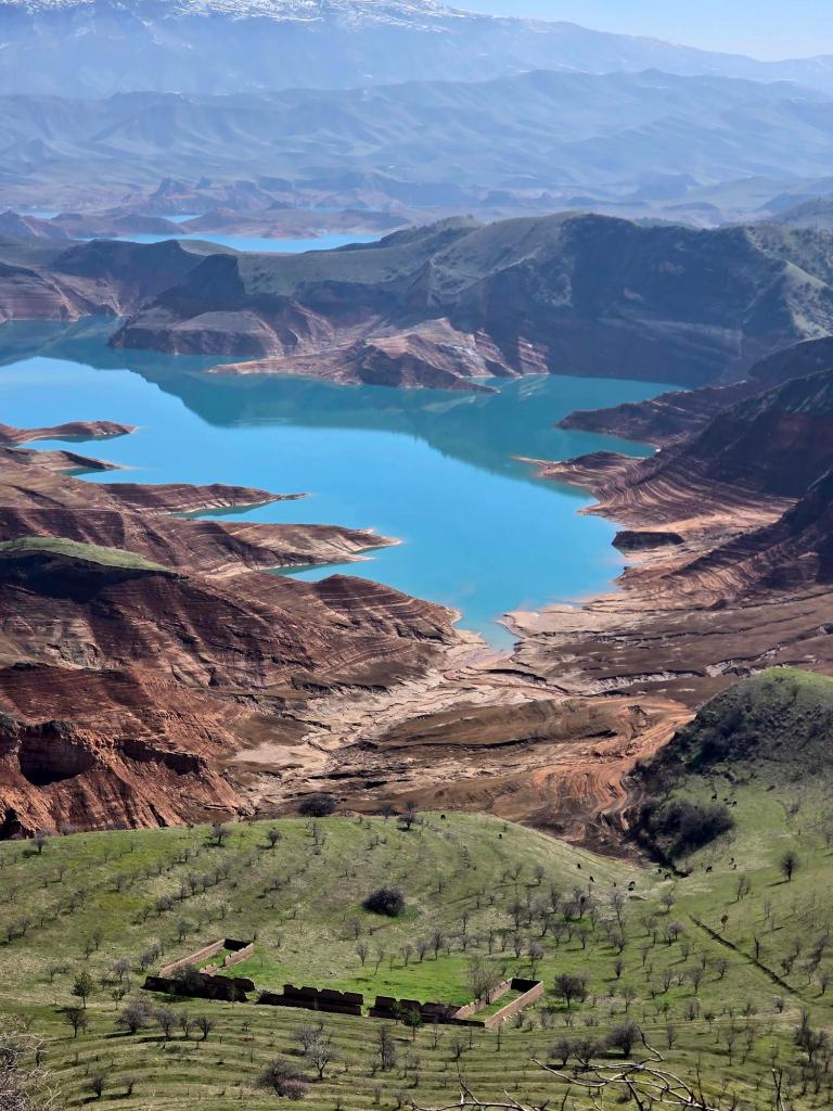
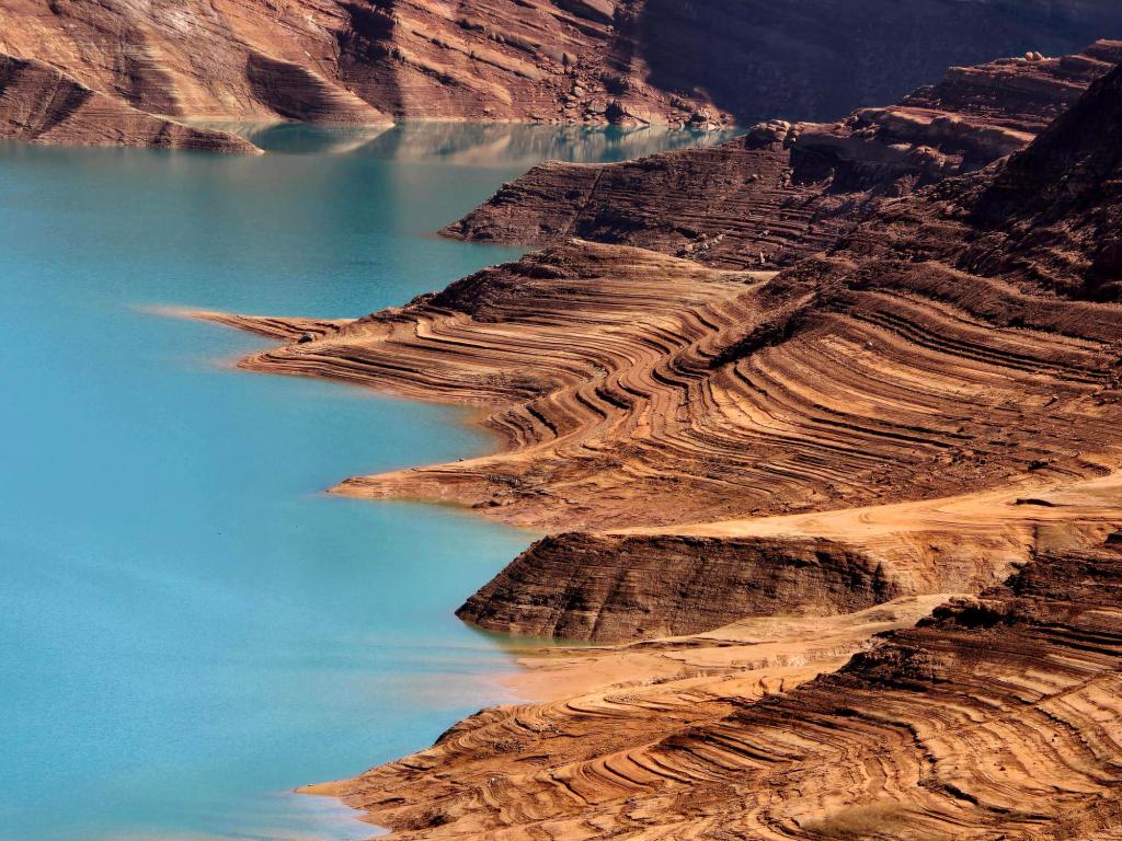

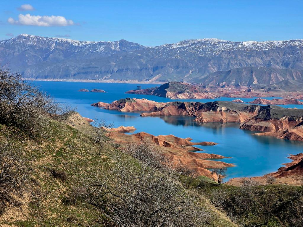
Eventually, we worked our way out onto a ridge still sitting a couple hundred feet above the shoreline. That’s where we stopped. Packs off, kids scattered across the grass, and lunch stretched out longer than it needed to. Below us, the shoreline looked thick with mud, and with a full crew of kids along for the day, it felt like a good place to call it.
The climb back up was just enough to remind us we’d earned the view—steady, a little warm, but never overwhelming. The kind of uphill that keeps everyone moving without complaints.
The reservoir itself is massive, far bigger than it first appears from the road, and it’s a place I keep thinking about going back to explore more. I’ve heard that by mid-summer the water actually warms up to a comfortable temperature—something I still haven’t experienced here in Tajikistan. Every river and lake I’ve stepped into so far, no matter the season, has been cold. Usually icy cold.
We made one more stop at a smaller fruit stand on the way back—another round of fresh juice, a bag of fruit for the road, and a few more minutes looking out over that stretch of blue before heading on.
An hour and twenty minutes later, we were back in the city.
Another Saturday well spent.

Leave a comment