Hiking deep into a spring-fed valley of roaring water, shifting boulders, and glacier-fed alpine lakes in Tajikistan’s Hissar Range.
🧭 Trail Stats
📏 Distance: 13.7 miles
⬆️ Ascent: 1,824 ft
⬇️ Descent: 1,811 ft
⏱ Total Time: 8h 40m
🚶 Moving Time: 6h 1m
🥾 Difficulty: Moderate / Hard (long distance with a steep final push)
📅 Date Hiked: May 4, 2025
Early last May, I joined my first real “sports hike” with the Daidushki group. The name might sound relaxed, but the pace certainly wasn’t. This was a group of hikers who came ready to move, and the objective for the day was Lake Payron, tucked high in a side valley above the Qaratoqh River.
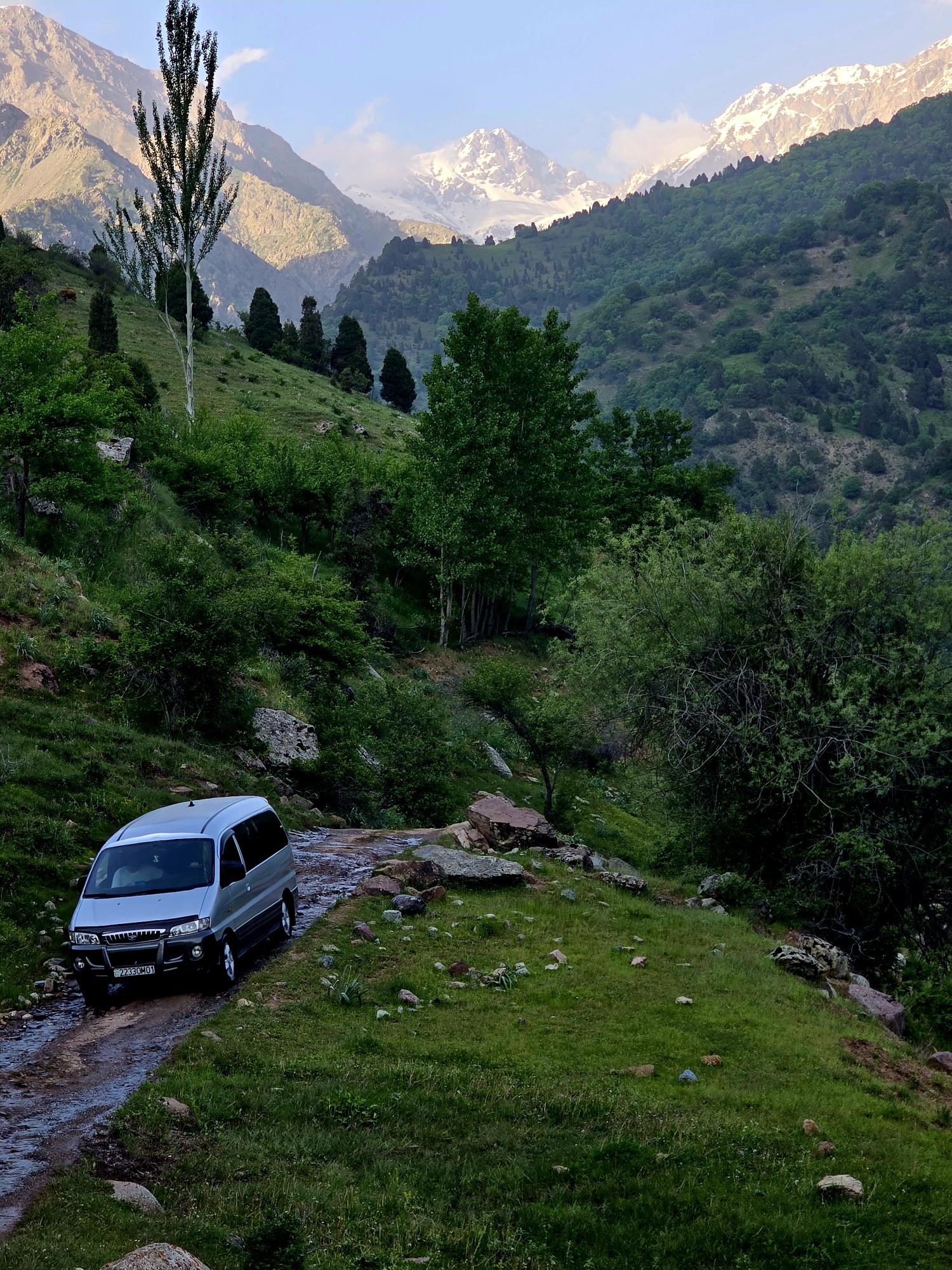
Just getting to the trailhead takes some commitment for a one-day outing. From Dushanbe it’s roughly a 2.5–3 hour drive, and the final stretch includes close to an hour of bouncing along rough mountain roads before reaching the same parking area used for the Timurdara Lake hike.
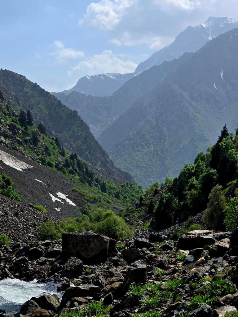
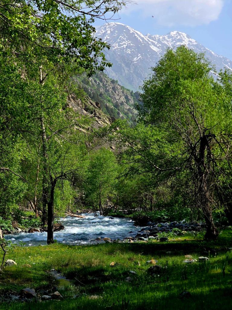
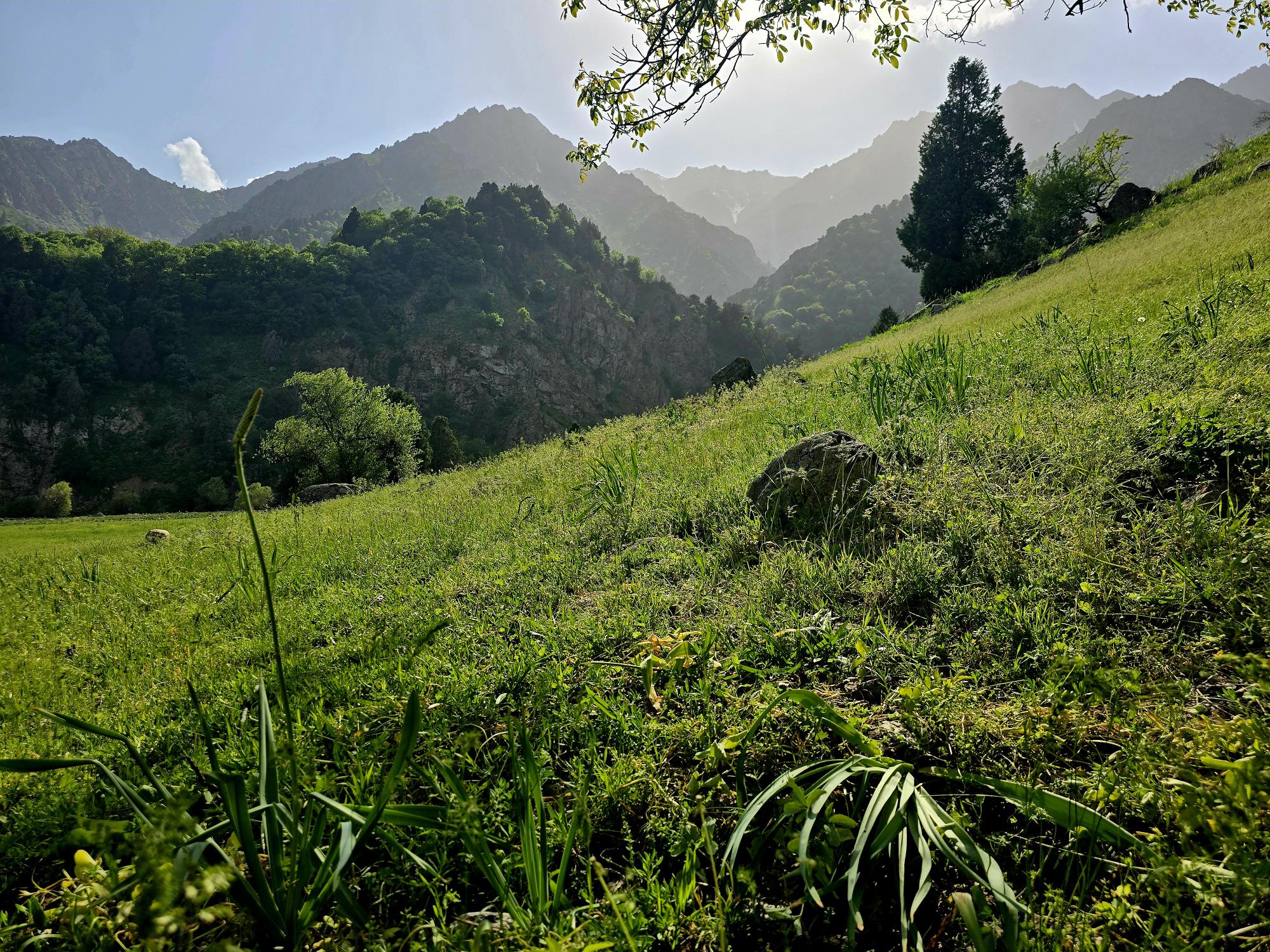
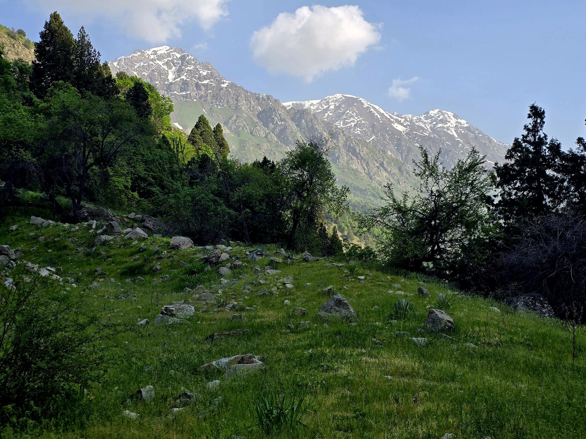
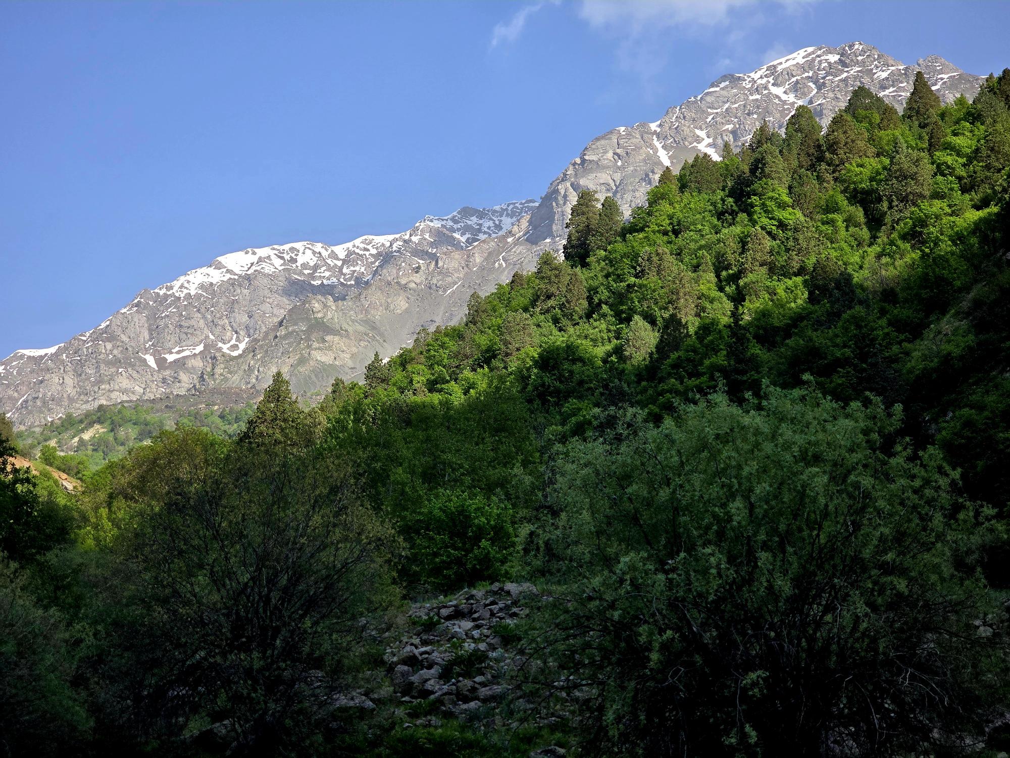
Early May is a beautiful time to be in the Qaratoqh River valley. Snowmelt from the high peaks sends water rushing through every channel. The main river runs strong and loud, while countless smaller tributaries pour down from the surrounding slopes. Everything was bright green from the spring growth, while the higher peaks behind the closer ridges were still showing patches of lingering snow.
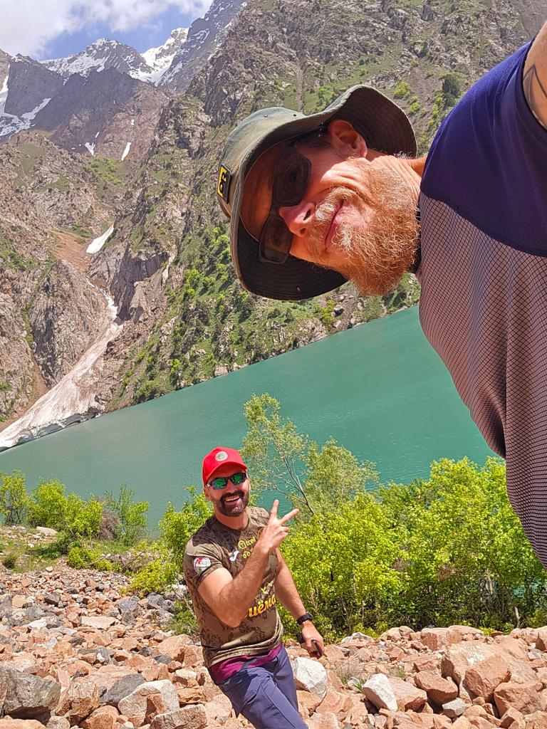
I was impressed by how many people had signed up for a hike this far from the city, but it turned out to be an enthusiastic mix of Russians, Tajiks, and a few expats, including my buddy Nick and me. Our front guide wasted no time getting things moving and quickly set a blistering pace, pushing us steadily deeper into the valley.
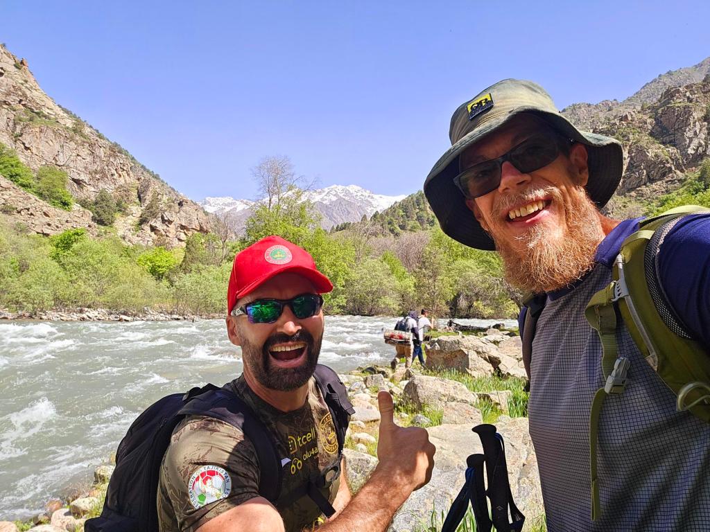
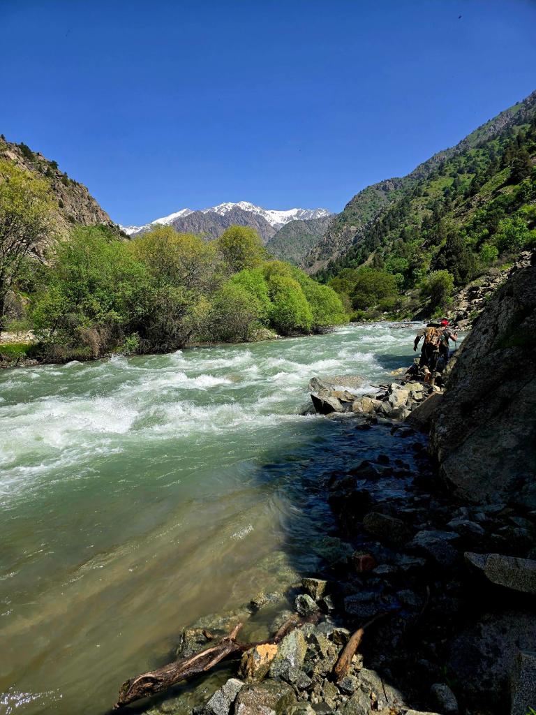
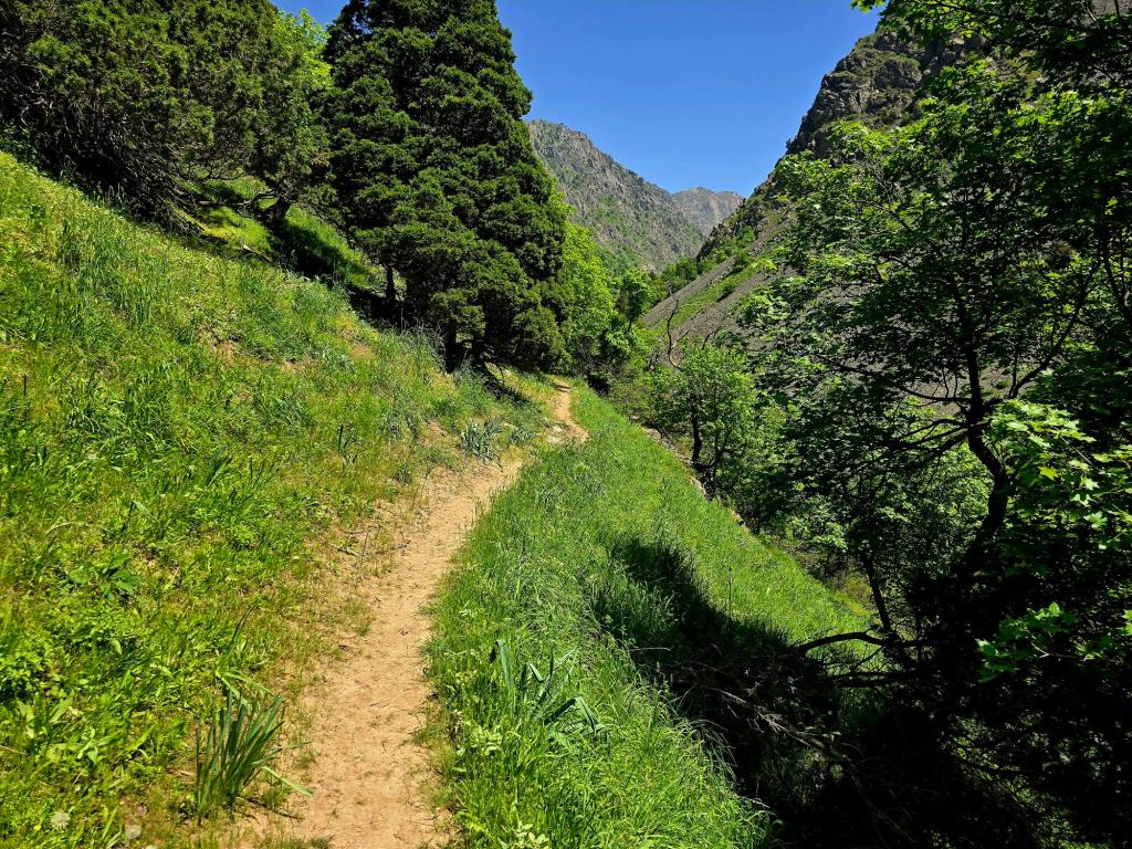
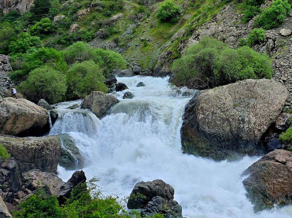
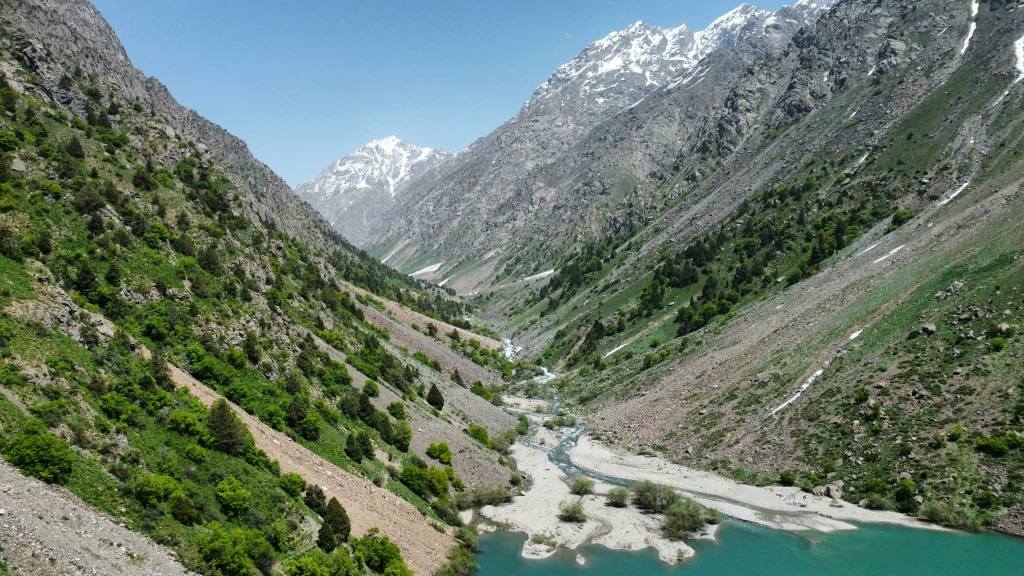
For the first several miles the trail follows the Qaratoqh River, and you’re rarely far from the thundering roar of the water. The river eventually feeds into the Amu Darya, known throughout Western history as the Oxus River, one of Central Asia’s great waterways.
As we moved along the trail I kept hearing something unusual — a deep thud echoing up from somewhere in the river. The first time I heard it I stopped and listened, wondering if I had imagined it. A few minutes later another one echoed through the valley. It sounded almost like distant rockfall.
Finally I happened to be walking beside one of the guides when another loud thump came from somewhere deep in the river channel. He stopped and nodded.
“Big stones,” he said.
The spring runoff was powerful enough to push massive boulders along the riverbed, where they slammed into other rocks with those deep booming impacts. He casually added that this was exactly why river crossings are dangerous this time of year—if you tried to ford one of these rivers without a bridge, the current could easily roll one of those submerged boulders into your legs.
After hearing that, I was very happy to stay on the trail.
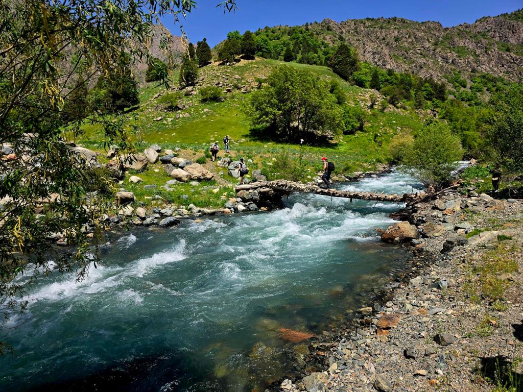
Around the 4.5-mile mark, the valley opens up and the trail arrives at what looks like a natural Y-intersection. A huge shady tree stands at the junction, making it a perfect place for a break. Packs came off and we took ten minutes for water and snacks.
From here the route crosses a small footbridge and cuts up the valley to the right, following the Payron River toward the lake.
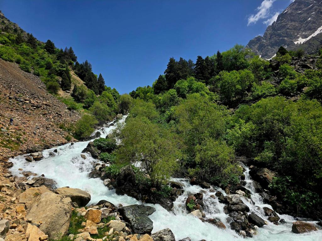
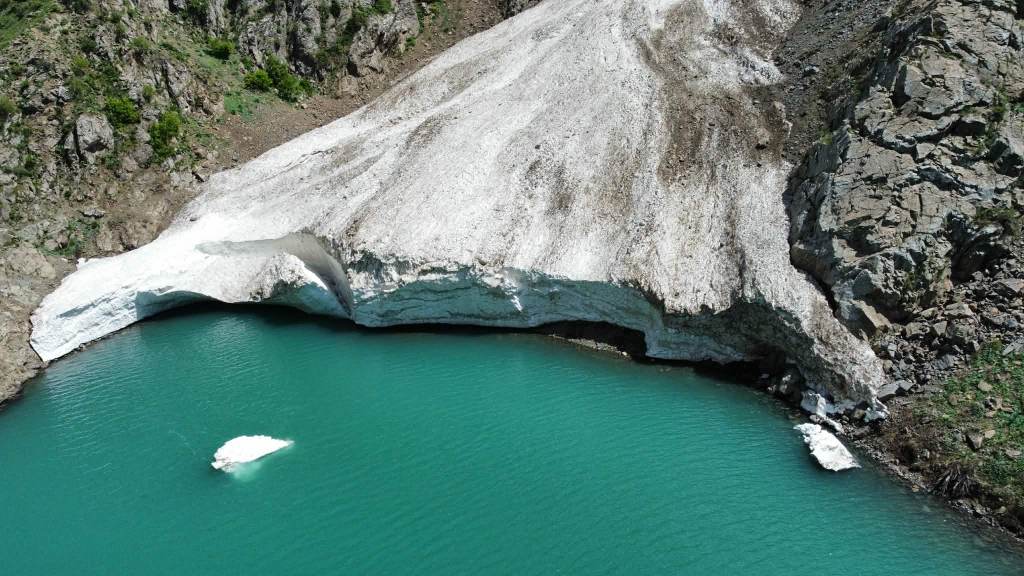
The trail climbs high above the river at first before gradually dropping back down toward its banks. This final valley stretch is just under 2.5 miles to the lake, and it includes some of the rougher terrain of the hike. Several long sections of loose rock slow the pace, and we passed a couple of snow and ice bridges where avalanches had piled up across the river earlier in the winter.
Eventually the trail reaches the final climb, where most of the elevation gain for the entire hike comes in the last mile. The slope steepens sharply here, and the trail winds upward through loose scree toward the basin holding the lake.
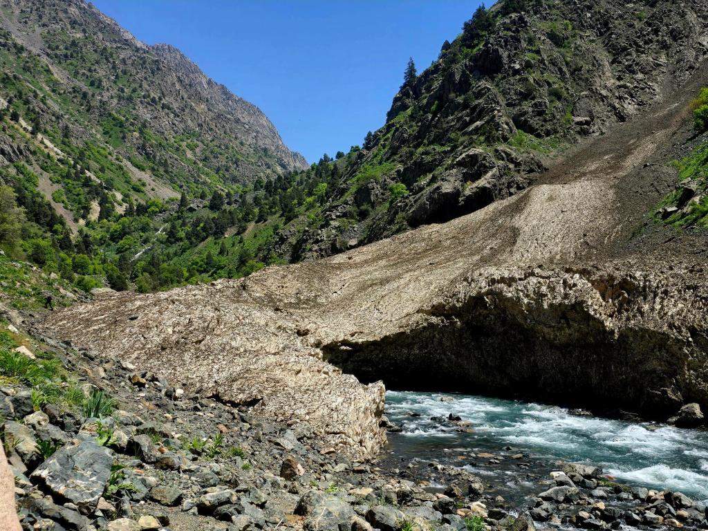
Even before the lake appears, the outlet stream is impressive. Water pours out through gaps in a massive rockslide that dammed the valley, spilling through a maze of boulders before gathering into a single fast-moving river below. Small waterfalls and channels twist their way through the rocks, eventually merging together as they race downhill.
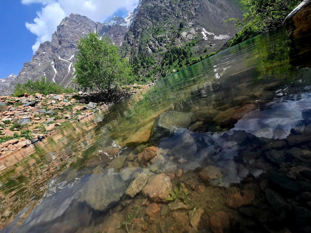
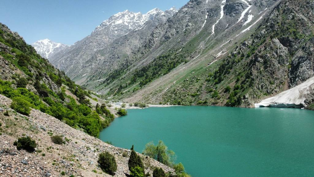
Then suddenly the trail crests the final rise and Lake Payron comes into view.
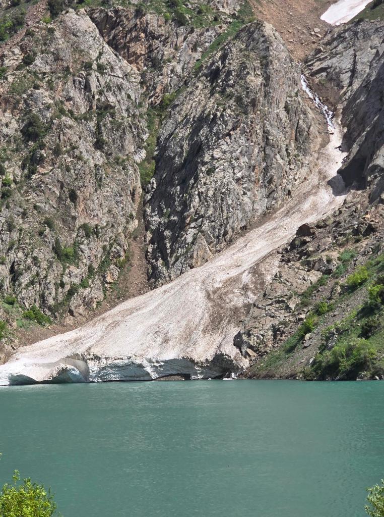
It’s a spectacular setting. The water is crystal clear, and mountains rise sharply from the far shoreline, giving the whole place a dramatic alpine feel. A large glacier spills down from the high peaks above and comes nearly all the way to the lake, stopping abruptly at the shoreline in a thick wall of solid ice.
Nick and I didn’t hesitate. Within minutes we had changed into shorts and jumped straight into the lake.
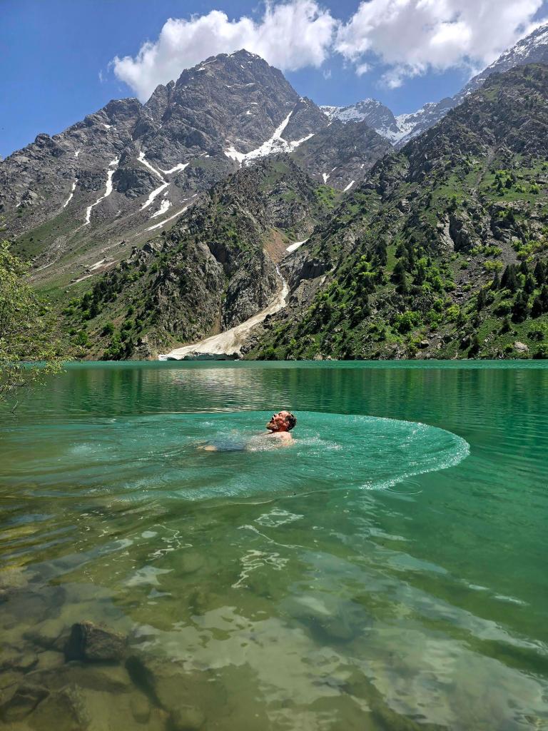
The water was shockingly cold. Even with a couple attempts, neither of us could stay in much longer than about a minute before scrambling back out. Still, it was the perfect way to celebrate reaching the lake.
After drying off we settled in for lunch and spent some time relaxing along the shore, soaking in the views. About an hour later we packed everything up and started the long push back down the valley.

The return hike moved quickly. By the time I passed the trail junction leading up toward Timurdara Lake, I was more than ready to see the end of the trail.
Exactly 8 hours and 40 minutes after setting out, I crossed the final bridge near the parking area and reached the vans. The rest of the group trickled in over the next forty minutes, one by one emerging from the valley.
Once everyone was accounted for, we piled back into the vehicles and began the long, bumpy ride back toward Dushanbe — tired, dusty, and already thinking about the next hike.
🌍 Geology Note: How Lake Payron Formed
Like many lakes in Tajikistan’s Hissar Range, Lake Payron appears to be a landslide-dammed lake. At some point in the past, a massive rockslide crashed down from the steep valley walls and blocked the narrow Payron River valley. Instead of flowing freely downstream, the water pooled behind this natural barrier of boulders and debris, gradually forming the lake that sits there today.
You can still see evidence of this origin where the lake drains. Rather than flowing through a single outlet channel, the water filters and cascades through a chaotic jumble of giant rocks, creating multiple small waterfalls before joining the Payron River below.

Leave a comment