Trail Stats
📏 Distance: 8 miles
⬆️ Ascent: 3,850 ft
⬇️ Descent: 3,850 ft
⏱ Total Time: 10 hours (7h 50m moving)
⚖️ Difficulty: Hard
📅 Date Hiked: March 8, 2026
Some hikes go a little harder than others. Sunday’s outing was just such a hike.
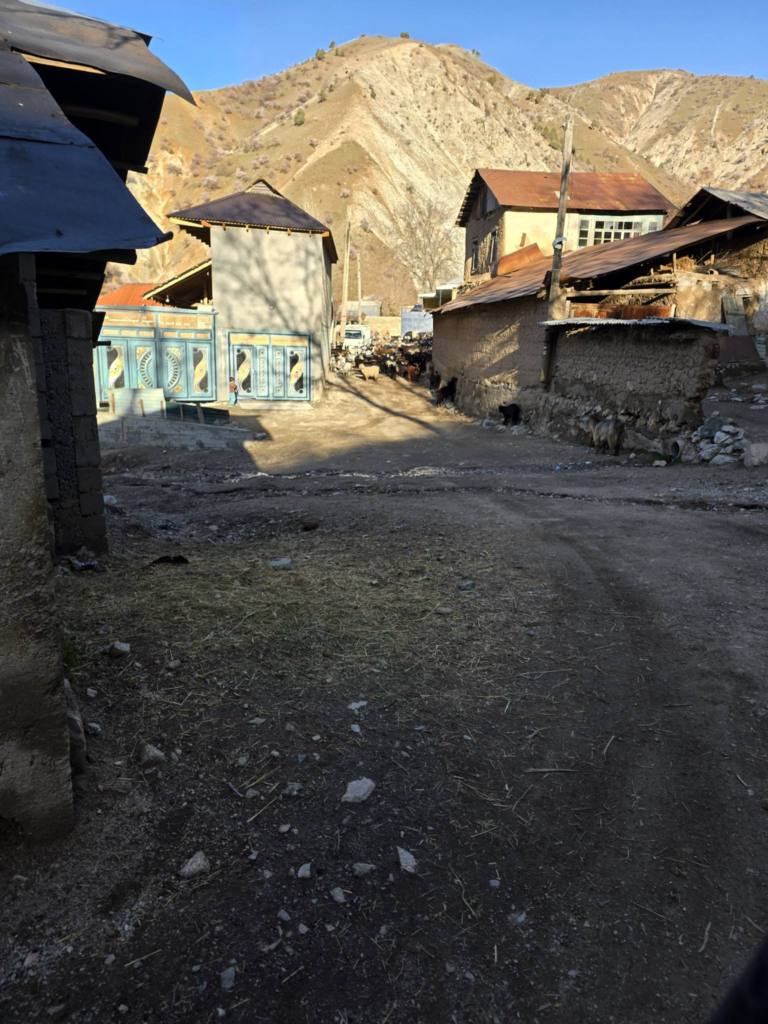
We had already climbed a good amount of vertical the day before, and then jumped straight into this long day early Sunday morning. Our buddy picked us up at the far north end of the city and we drove up the familiar road into the Varzob Valley toward Kharagon, the same village where we had finished our hike the afternoon before. This time we continued through Kharagon and drove another mile or so to the last village in this small side valley — a place called Dara.
At first the name threw me off. I’ve hiked out of another village called Dara several times before, but that one lies an equal distance east of the city. As the crow flies the two aren’t terribly far apart, but connecting them directly would require crossing a serious mountain pass somewhere in the middle. That might be a good excuse for an overnight trip later in the warmer months.
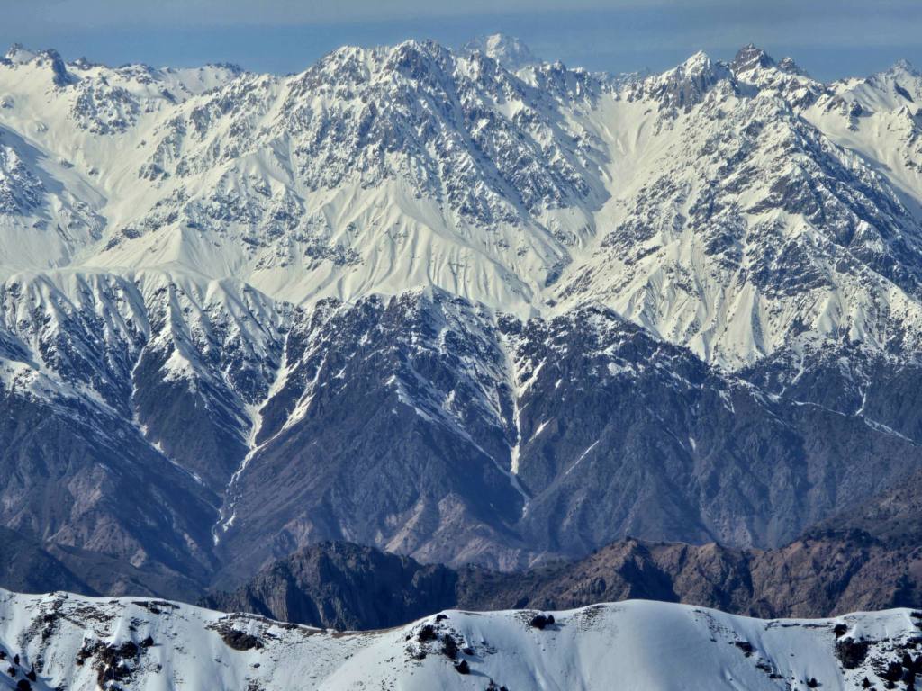
From the village we picked up a faint path that dropped down into the neighboring valley where a swift, snow-fed river rushed through the bottom. A couple of friends in the group had been here back in January and immediately noticed how much the river had risen in the weeks since. Our goal for the day was Mushteppa Peak, along one of the prominent ridges rising above this valley along the southern edge of the Hissar Range, but the conditions were already hinting that the day might not go exactly as planned.
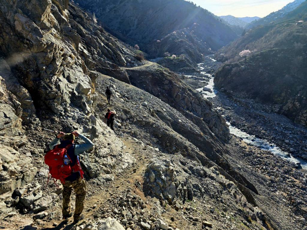
About half a mile in we reached a confluence. The route we originally intended would have followed the river up to the right and required somewhere around twenty to thirty crossings before the real climbing began. The problem was that we couldn’t even see a safe way to make the first crossing, much less dozens more after that.
Instead, we began scouting upstream to the left and spotted a possible jump between two large rocks in the middle of the current. The last time I attempted a leap like that a few months ago I trusted the grip on my boots, landed on a slick rock, and ended up waist-deep in a freezing river. I wasn’t eager to repeat that experience. Just then a local villager came walking by and told us there was a bridge just around the bend.
Sure enough, a few minutes later we reached it.
The bridge itself was a wild construction — a semi-braided lattice of small tree branches, and thin flexible limbs almost like vines, all woven together with a couple strands of wire and anchored into the banks on each side. It looked like something assembled in an afternoon with whatever materials happened to be nearby. Stepping onto it required a bit of faith. It hung only four or five feet above the water with plenty of flex, and while falling in wouldn’t have been catastrophic, it would have effectively ended the day for anyone unlucky enough to take the plunge.
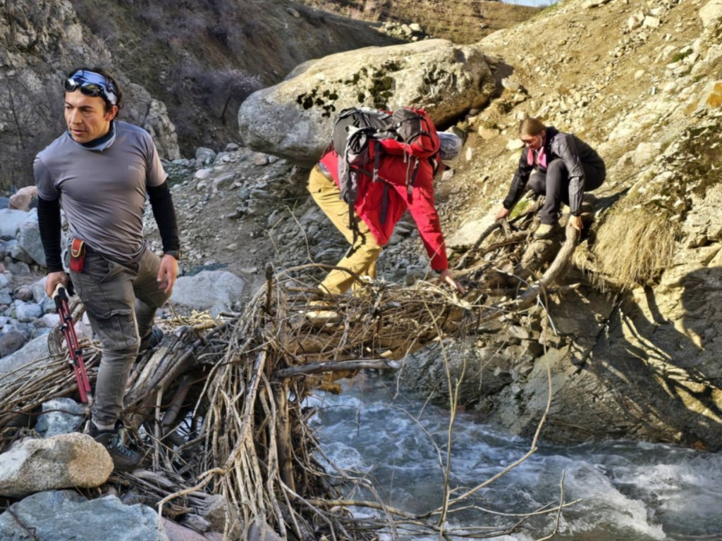
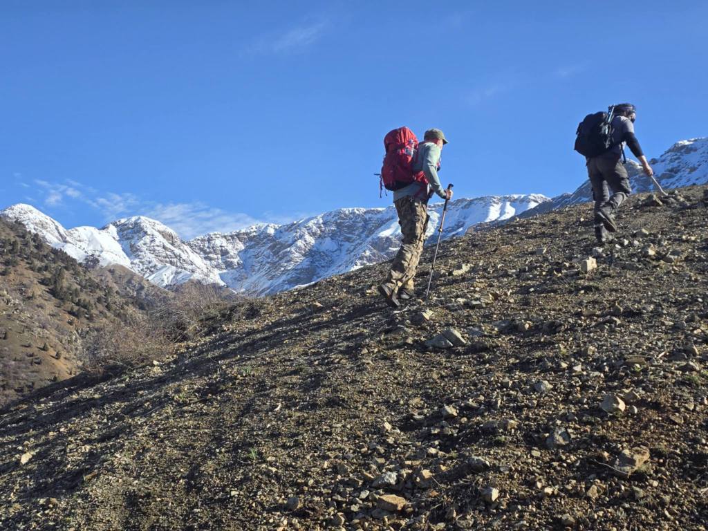
One careful crossing later, and the trail immediately pointed toward the sky.
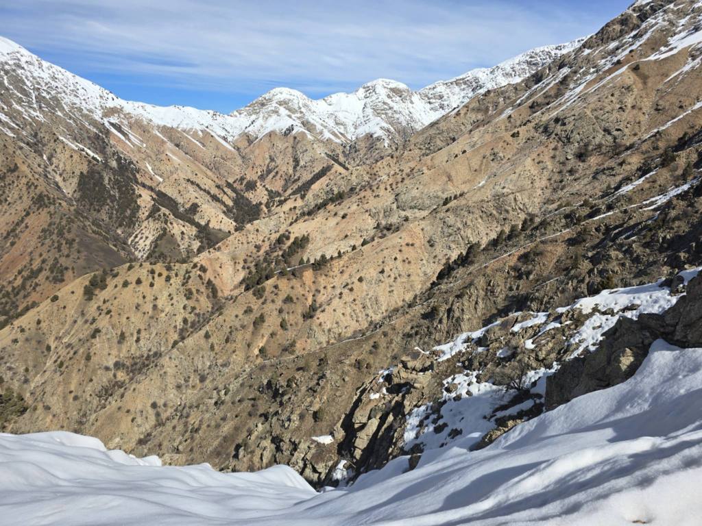
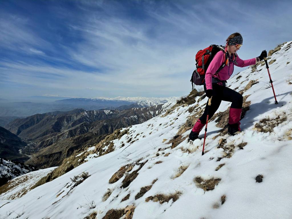
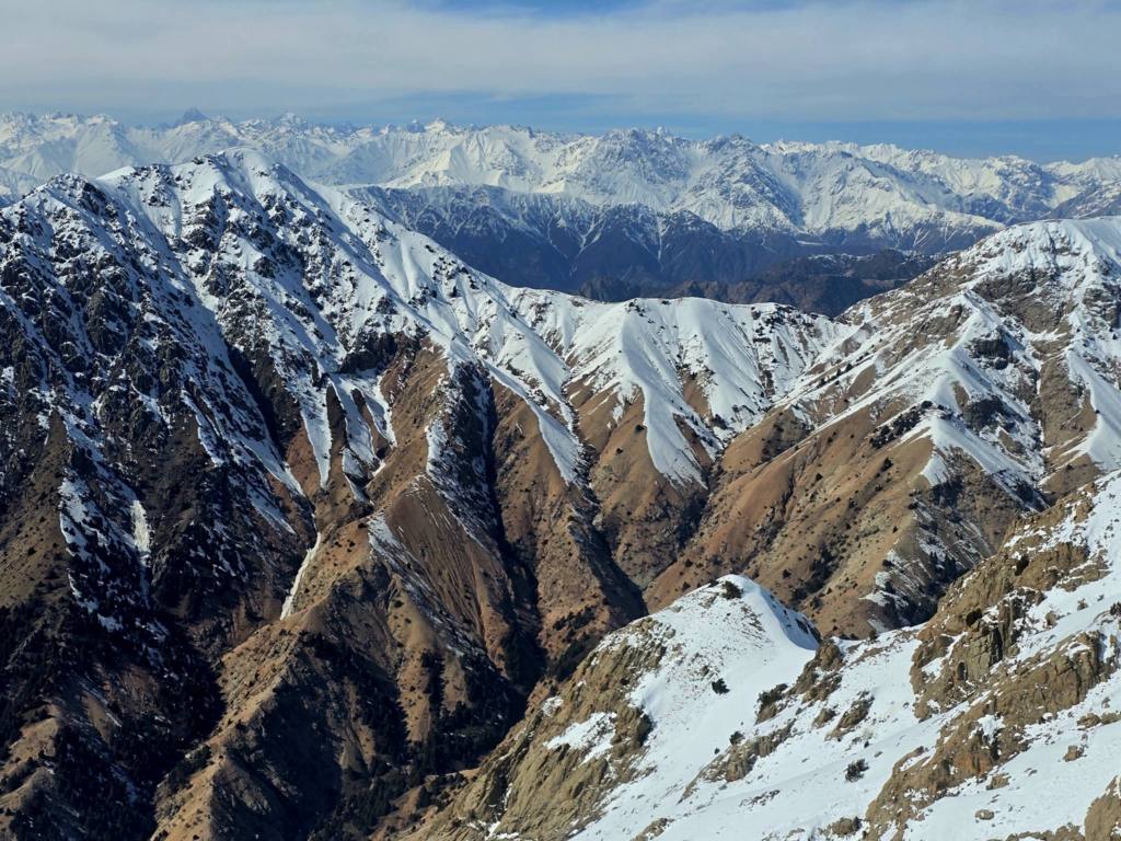
The first thousand vertical feet came quickly. As we climbed, the views began opening in every direction. The valley we had just crossed curled away below us toward the confluence, while another valley stretched off to the right, backed by a long wall of mountains that eventually tied into the high ridge we hoped to reach.
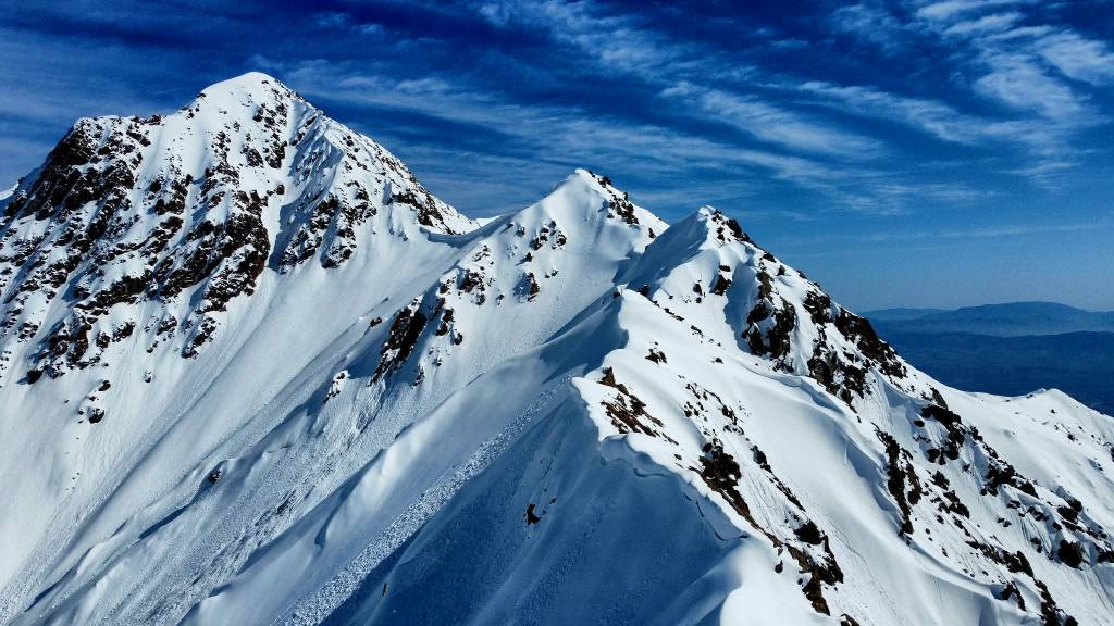
These ridges form part of the outer southern ramparts of the Hissar Range — a maze of grassy slopes, gullies, and long broken ridgelines that rise abruptly from the Varzob Valley just north of Dushanbe. From the road they look modest enough, but once you start climbing them the scale quickly becomes apparent.
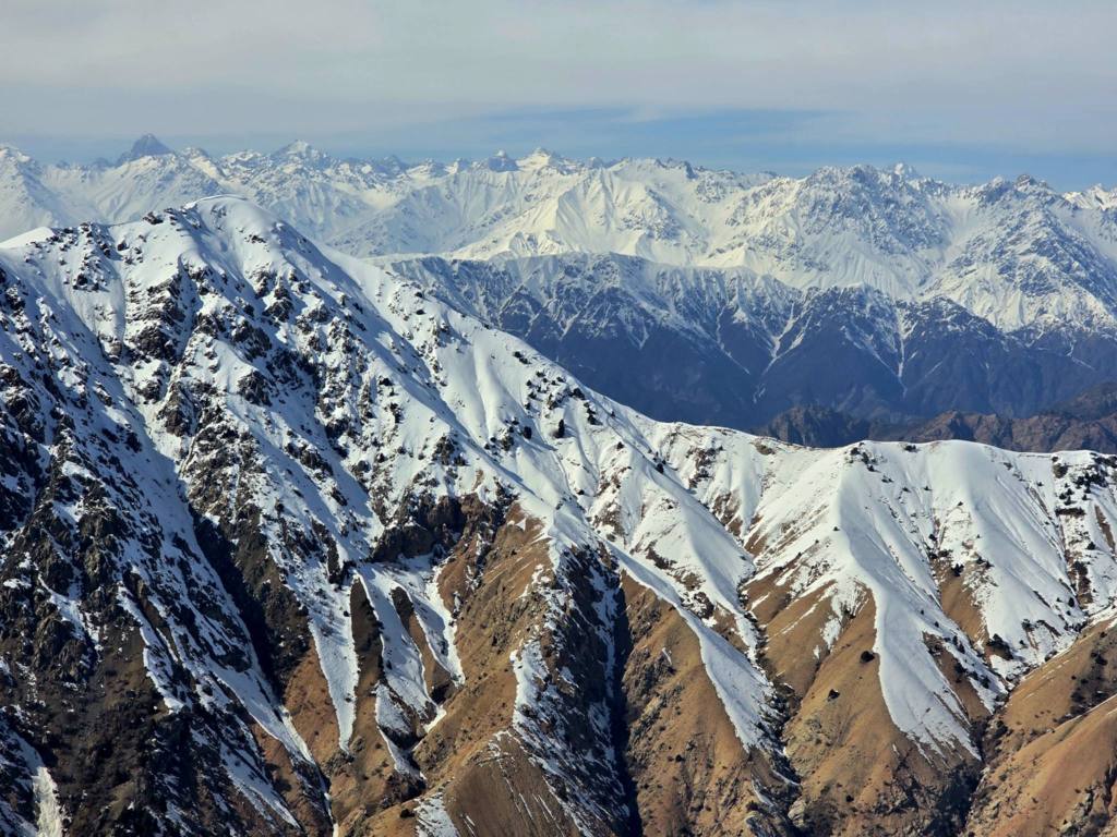
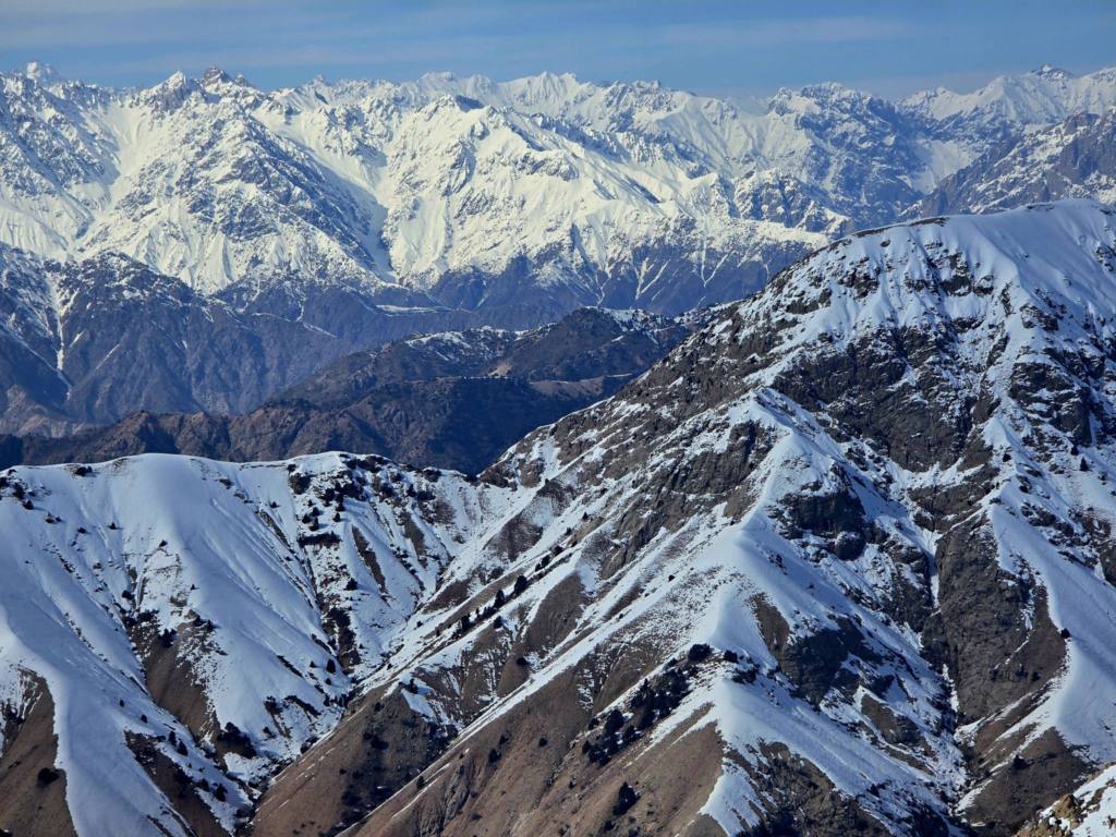
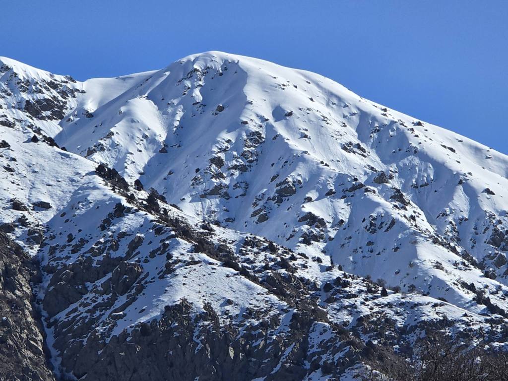
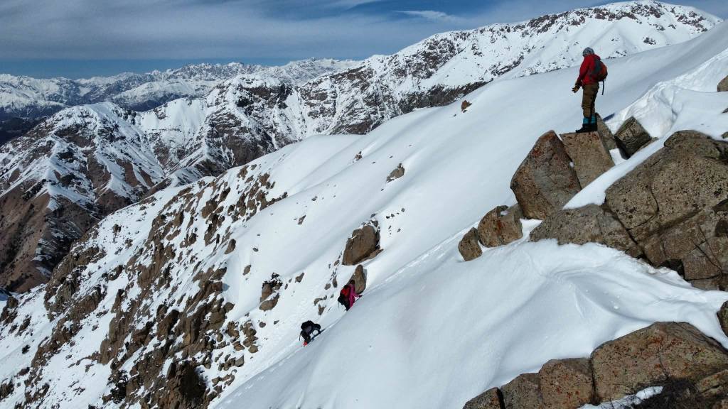
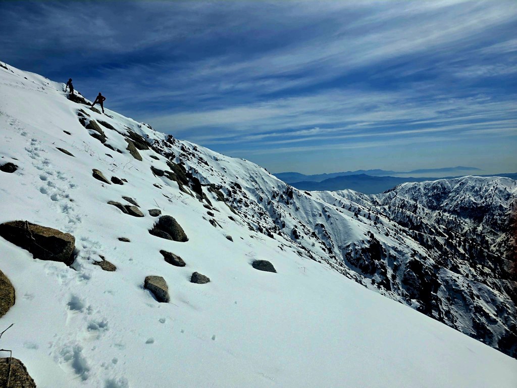
After a long steady climb we reached a plateau where the terrain finally opened up enough to get a clear view of Mushteppa itself. The summit rose across the valley along a jagged ridge line, and from where we stood it was already looking like a long way away. There was a ridge off to our left that appeared to offer a line up to the main crest, but the traverse all the way across to the peak was already beginning to look doubtful.
Still, getting up high seemed worth the effort, so we aimed for the ridge.
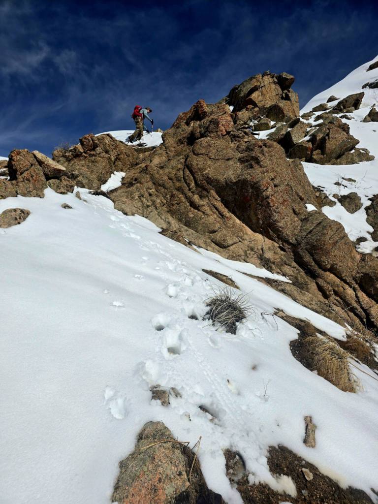
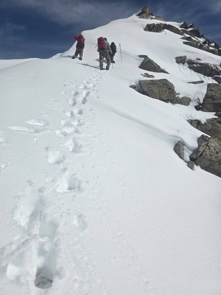
The shepherd’s trail we had been following dropped away briefly before climbing again toward the slope we wanted. Not long after that, the trail simply faded out and the climb turned into a direct scramble toward the ridge.
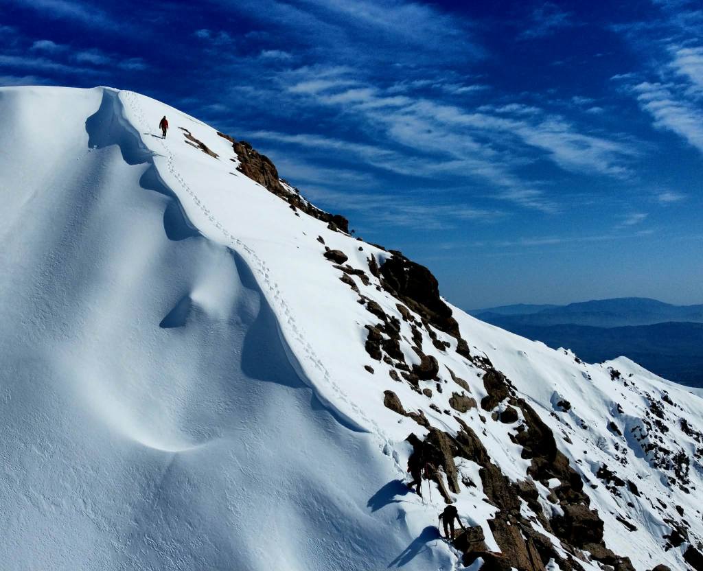
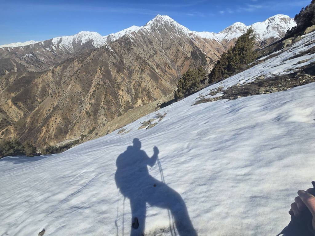
As patches of snow began appearing we stopped to throw on gaiters and drink some water. From there the terrain steepened dramatically. A long stretch of incline combined soft snow, slick mud, and loose ground that made every step deliberate. Higher up the snow deepened, which ironically made things easier — at least the footing became more predictable.
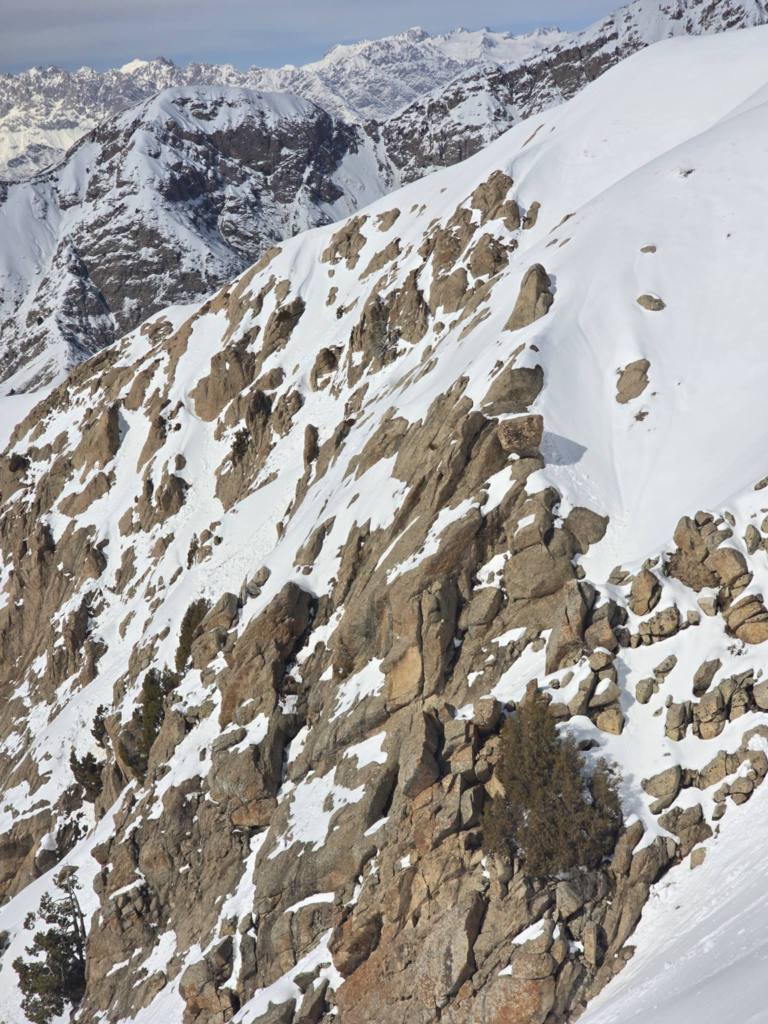

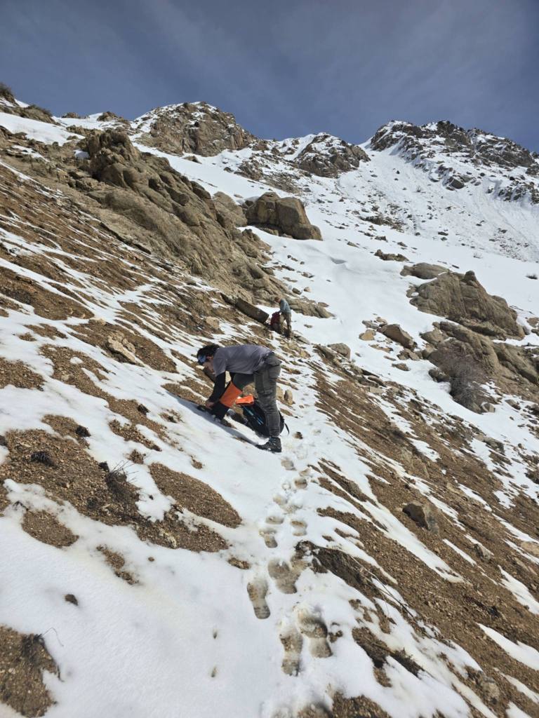
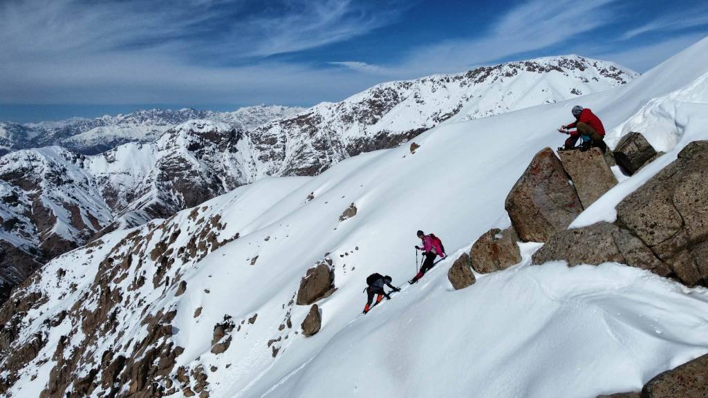
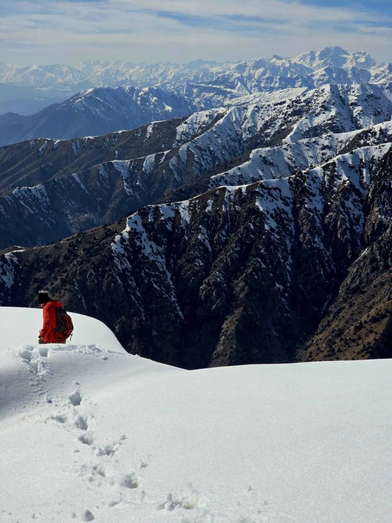
Several steep gullies had to be climbed along the way. The higher we pushed the steeper everything seemed to become, and somewhere along that slope my sense of self-preservation and a mild case of vertigo started teaming up against me. Near the top the snow was deep enough that we were sinking to mid-thigh in places.
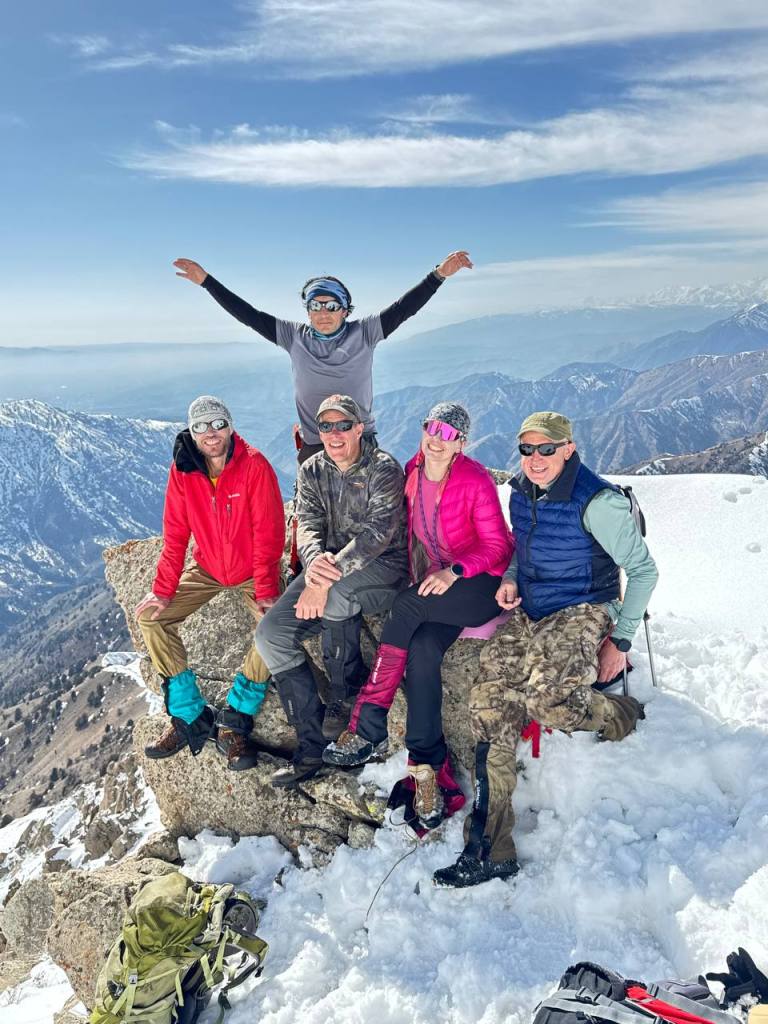
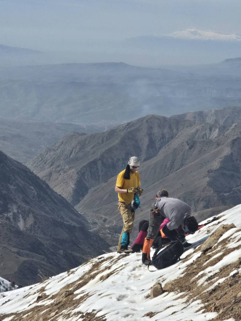
Eventually we reached a large rocky outcrop sitting about a hundred meters below the summit. From there the entire valley unfolded beneath us in an incredible panorama of ridges and snow-streaked slopes. A few in the group decided that was high enough and broke out lunch while the rest continued up the final steep push to the highest ridge for the day.
We lingered there for quite a while, soaking it all in.
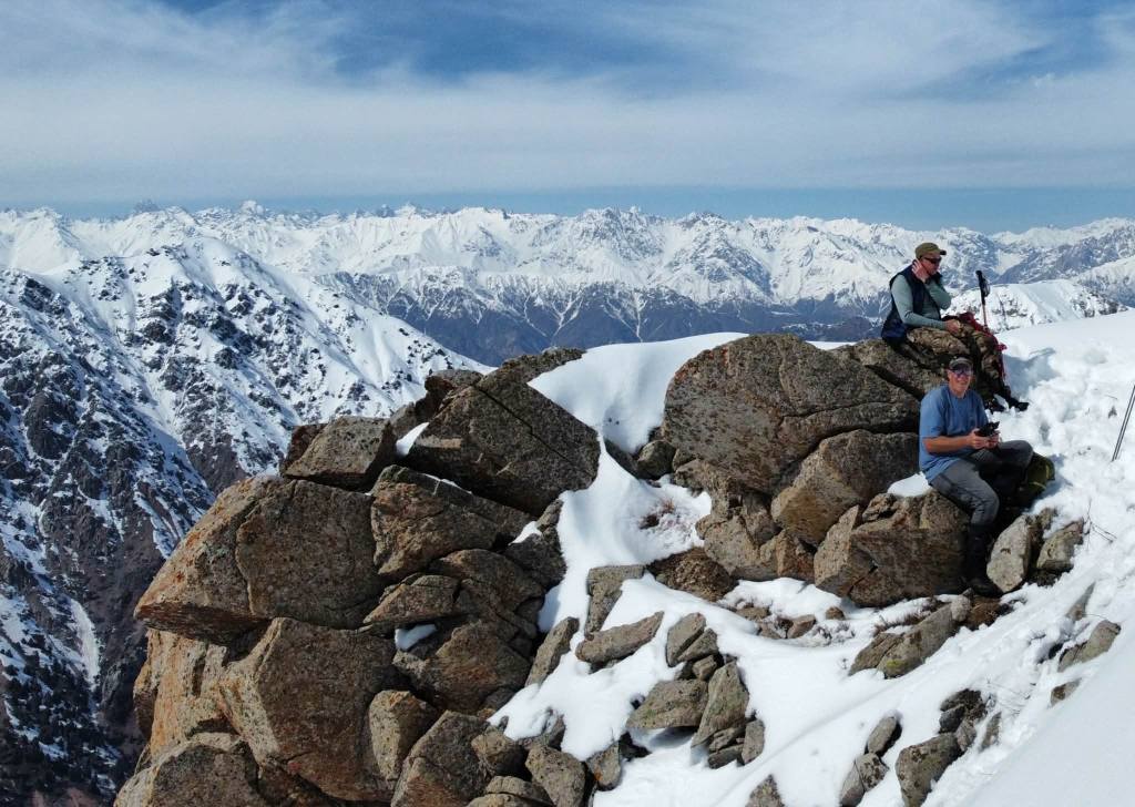
Part of me was already thinking about the descent. Knowing how steep the climb had been coming up, I had no illusions about what awaited us on the way down, so I was happy to stretch the break as long as possible.
Eventually though, the clock forced our hand. It was approaching 3 p.m., leaving us about three and a half hours of daylight to make it back to the village.
The descent went steadily, and aside from a few short breaks we kept moving the entire way. By the time we reached the river crossing again the sun was beginning to sink behind the western ridges, casting long shadows across the valley. One more careful crossing of the improvised bridge and we stepped back into Dara nearly nine and a half hours after we had set out.
This is definitely a place I want to return to in late summer.
Looking at the maps later that evening, it appears there’s a long ridge traverse possible across several of the peaks surrounding that valley. Linking them together would likely make for a two- or three-day backpacking loop across the high ridges above Dara.
That’s a trip worth coming back for.

Leave a comment