📊 Hike Stat Box — Langar Petroglyphs
Date: 11/17/2024
Trailhead: Upper edge of Langar village
Destination: Upper petroglyph fields
Distance: ~3.5–5 km round trip
Hike Time: ~2–3 hours (longer with exploration)
Elevation Gain: ~350–500 m (1,150–1,650 ft)
Starting Elevation: ~2,900 m (9,500 ft)
High Point: ~3,250–3,400 m (10,660–11,150 ft)
Difficulty: Moderate
Terrain: Steep hillside, rock slabs, faint footpaths
Exposure: High sun and wind, no shade
📊 Drive Stat Box — Pamir Highway (Day Six)
Route: Langar → Khargush Pass → Bulunkul
Driving Distance: ~140 km
Driving Time: ~7–8 hours
Highest Point: Khargush Pass — 4,287 m (14,065 ft)
Elevation Range: ~2,900 m (Langar) → 4,287 m (Pass) → ~3,700 m (Bulunkul)
Road Conditions: Remote dirt road, steep climbs, exposed terrain
Difficulty: Challenging (altitude, isolation, weather exposure)
Highlights: Afghan border route, caravans, Khargush Pass, high-Pamir plateau
Overnight: Homestay in Bulunkul
Langar to Bulunkul — Shrines, Stone, and the High Roof of the World
We woke up in Langar to an intensely blue sky and stepped out into our homestay’s large backyard. The family’s big dog was already waiting for attention, tail wagging enthusiastically. After giving him some love, washing up, and eating breakfast, we packed the car and got ready to begin the day.
I was already excited for our first stops—both just outside the village.
Shoh Kamari Oftob — Master of the Sun
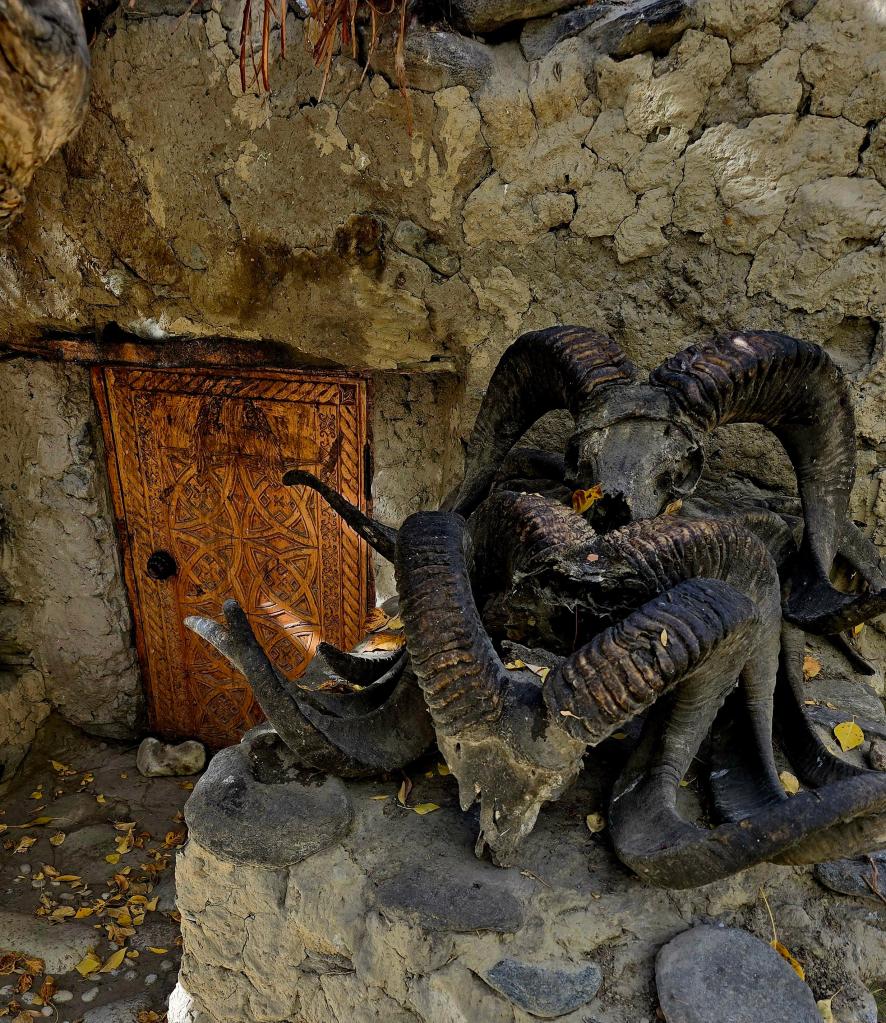
Just beyond the edge of Langar sits one of the Wakhan’s most evocative sacred places: Shoh Kamari Oftob, often translated as “Master of the Sun.” At first glance, it’s easy to overlook or misunderstand. Ancient trees surround the site, their branches hung with ribbons and prayer cloths, while the ground is scattered with ibex and Marco Polo sheep horns and skulls, carefully arranged rather than discarded.
These horn collections aren’t trophies in the usual sense. Across the Pamirs—especially in the Wakhan—such displays are tied to mazars, local sacred shrines that blend pre-Islamic traditions with later Ismaili practices. Shoh Kamari Oftob is widely believed to preserve echoes of ancient solar reverence, possibly linked to Zoroastrian cosmology, where the sun symbolized truth, life, and cosmic order. While Islam has long been the dominant faith here, older beliefs weren’t erased so much as absorbed and reshaped through local tradition.
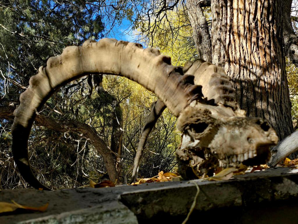
The animals represented—ibex and argali (Marco Polo sheep)—hold deep symbolic weight in high-mountain cultures. Strong, elusive, and perfectly adapted to steep terrain, they were essential for survival and powerful spiritual symbols. Leaving horns at sites like this was a way of showing respect, offering gratitude, or asking for protection and balance in a harsh mountain world.
What makes Shoh Kamari Oftob especially striking is how seamlessly it fits into the landscape. There are no walls or grand structures—just stone, trees, sky, and silence. Standing there, with the Wakhan spread out below and the Hindu Kush rising beyond, it’s easy to understand why this place mattered long before borders, before roads, and even before written history reached these valleys.
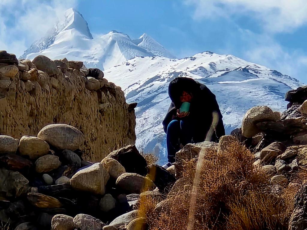
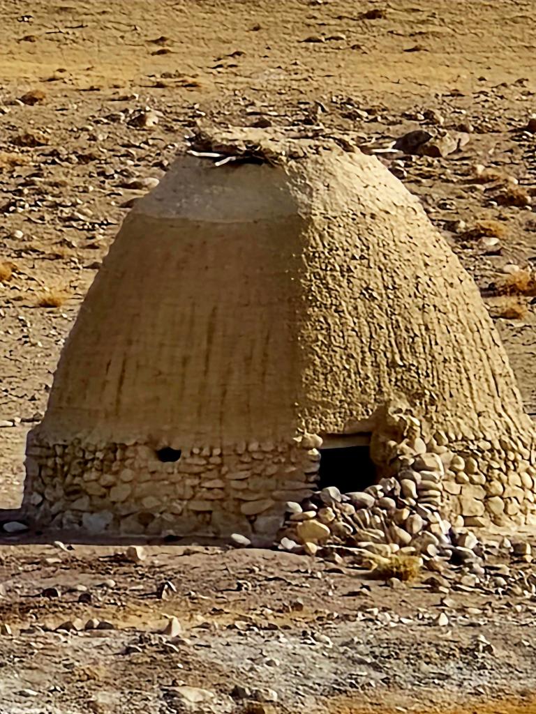
Near the center stood a low stone structure with hearths for lighting fires. The number of Marco Polo sheep and ibex skulls was impressive. Nothing here felt random. The way stones were set into the floor at the entrance, the intricate carvings on the wooden door, and the careful placement of skulls all spoke to deliberate design and long-held meaning.
Along one rock wall descending from the main structure, ibex skulls lined the stone from one end to the other. Some looked ancient, smoothed by time, while others still had tufts of fur clinging to the bone. We stayed nearly forty minutes without seeing another person enter or leave.
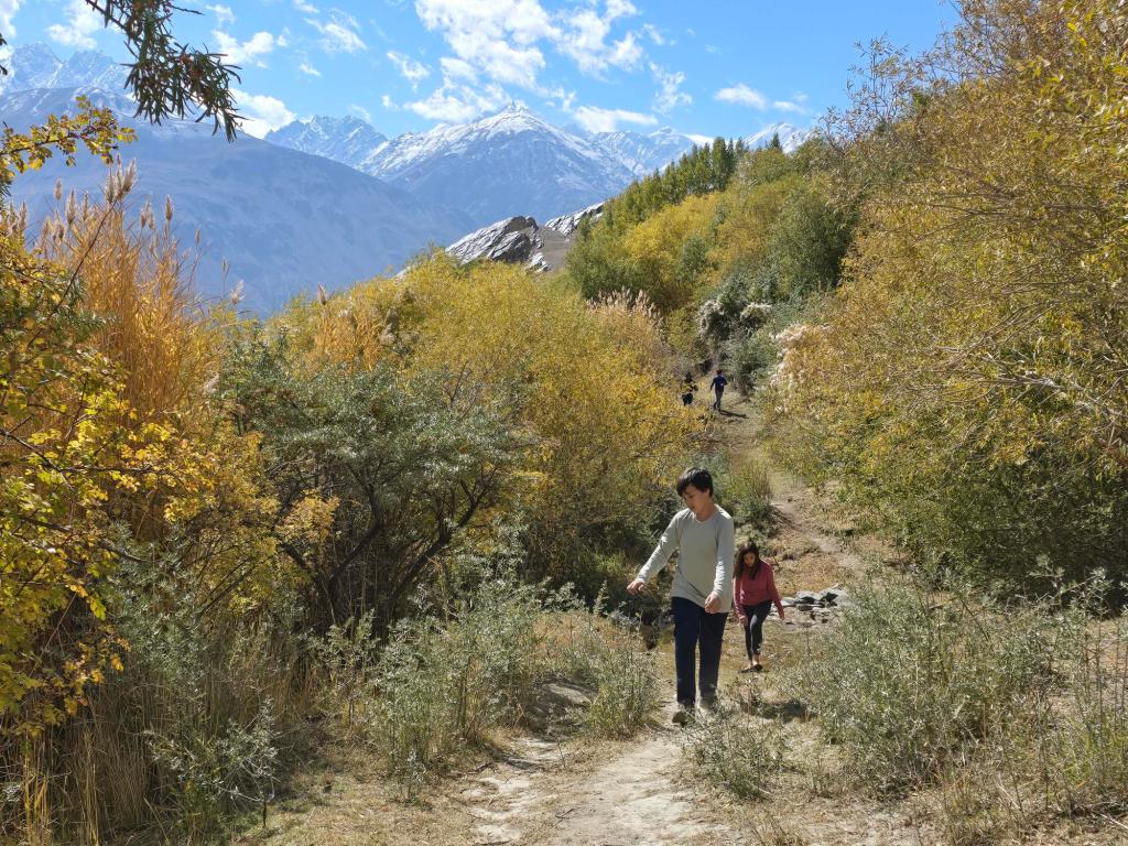
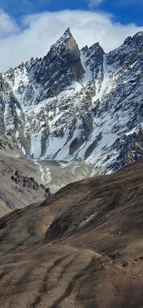
High Above Langar — The Petroglyphs
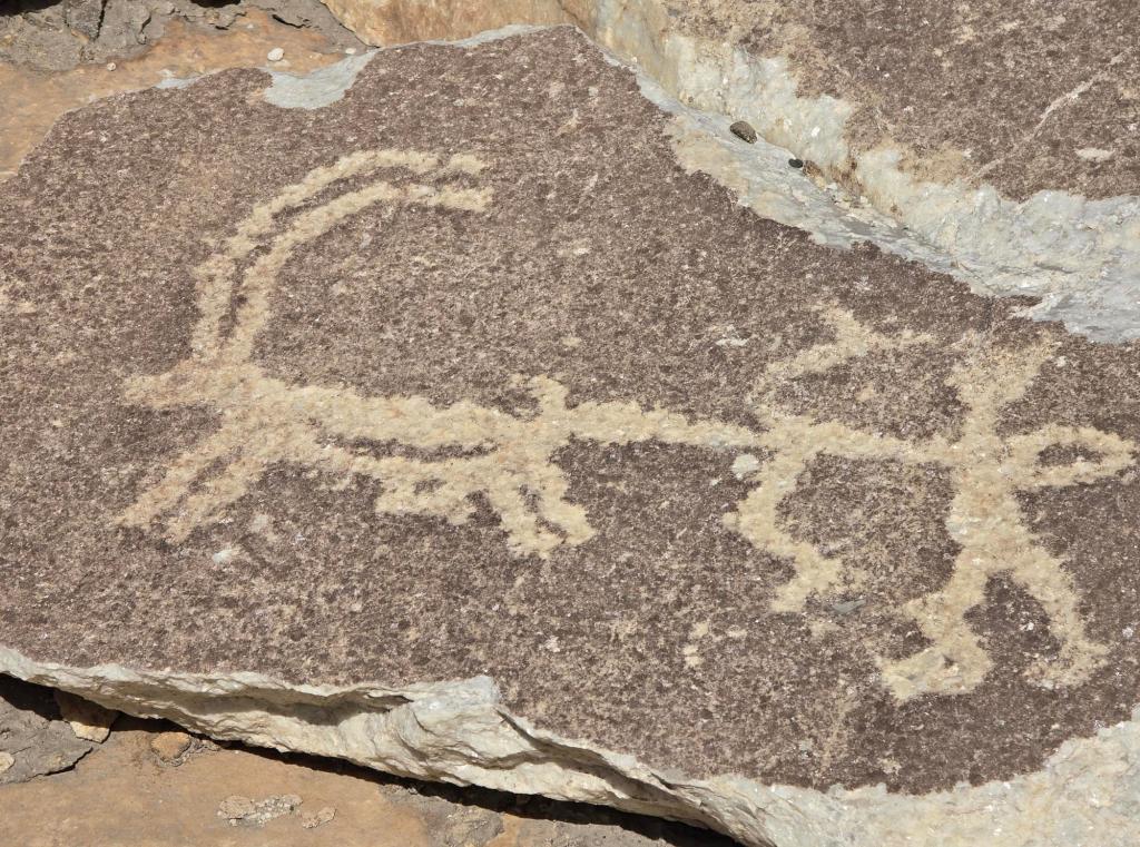
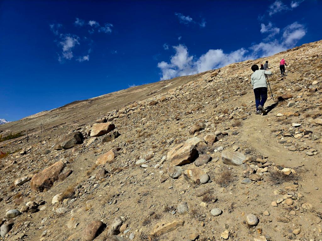
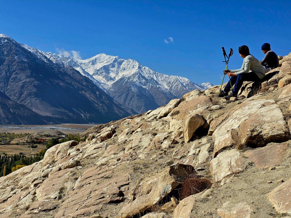
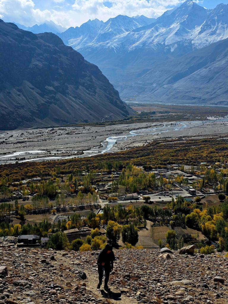
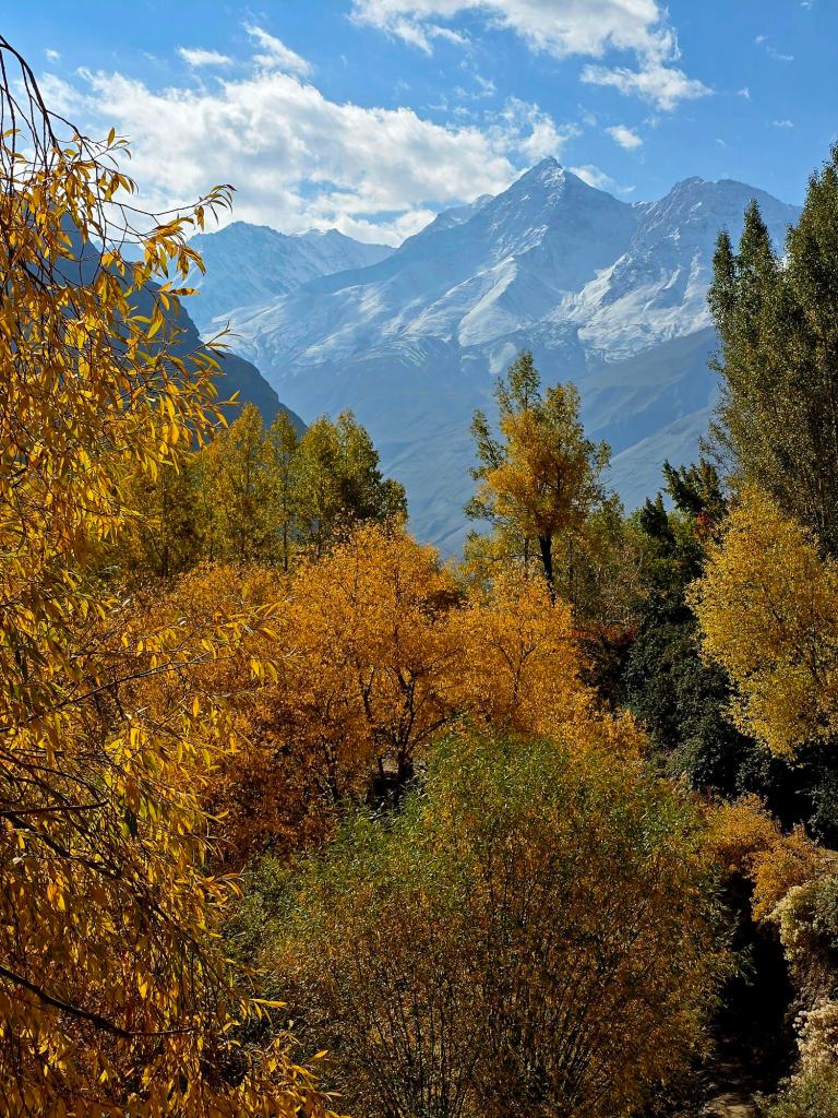
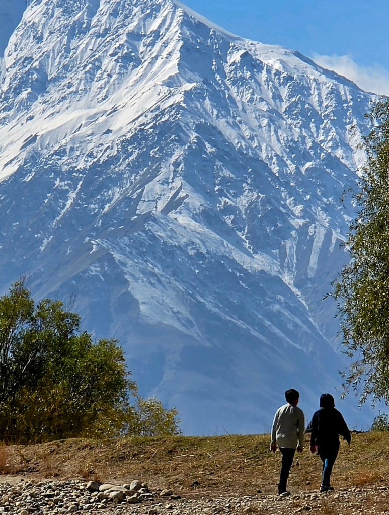
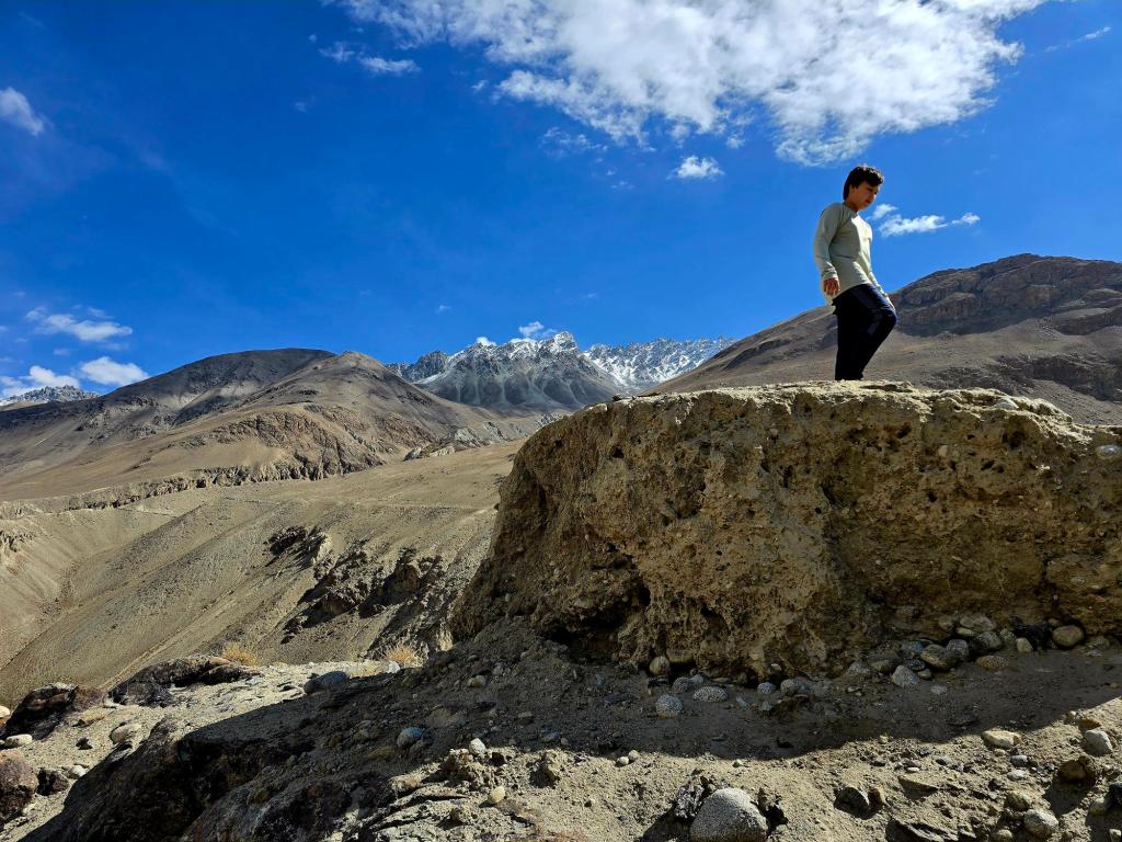
From the shrine, we drove to the base of the slope above town and set off on foot toward the petroglyph fields. We climbed several hundred meters above Langar on faint footpaths and open rock slabs. The hike is short in distance but steep in places, and the carvings are spread across a wide vertical band of hillside rather than concentrated in one spot.
By the time you reach the upper panels, you’re well above 3,000 meters, with uninterrupted views back down the Wakhan Valley. It’s an easy place to lose track of time, wandering from panel to panel and only later realizing how high you’ve climbed.
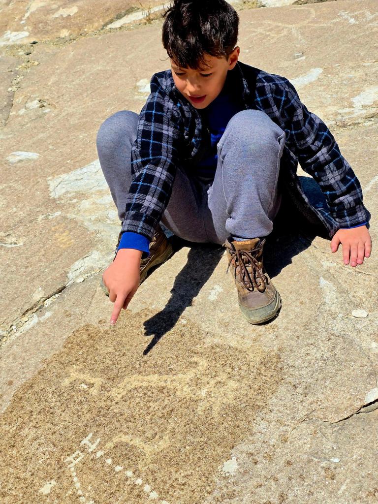
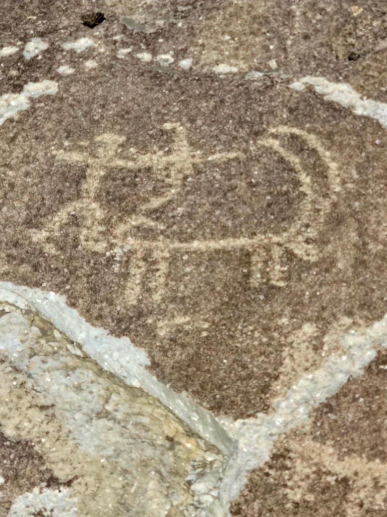
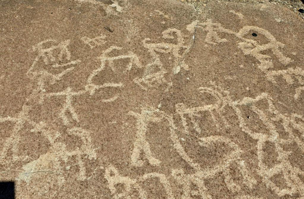
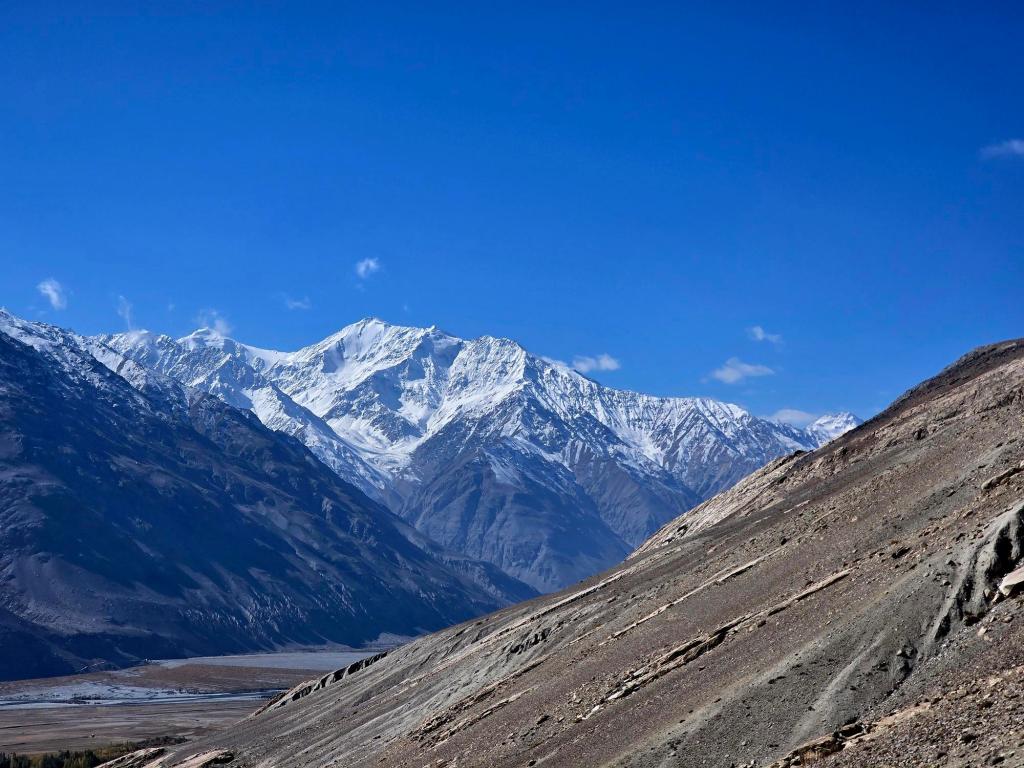
The slopes above Langar hold one of the richest collections of petroglyphs in the Pamirs, with thousands of carvings etched into smooth granite. Many are believed to date back centuries, and some possibly to the Bronze Age. The most common images are ibex and Marco Polo sheep, their sweeping horns carved with care, alongside hunters with bows, horse riders, and abstract or symbolic figures.
These carvings are thought to have served ritual or spiritual purposes—perhaps linked to hunting success, seasonal movement, or reverence for animals that sustained life in the high mountains. Later inscriptions and Islamic motifs appear alongside older images, suggesting this hillside remained meaningful across changing belief systems. Like the shrine below, the petroglyphs feel less like relics and more like part of a living ritual landscape.
Fortresses of the Wakhan — From Heights to Riverbanks
Before leaving Langar for good, we made one more quiet stop — this time down near the river, at the ruins of another fortress. Unlike Yamchun, which dominates the valley from above, this one sat low and close to the Panj, its walls built from rounded river stones and largely reclaimed by time. This was Kakhkaha Fortress, one of the Wakhan’s older and lesser-known defensive sites.
Walking through its collapsed rooms and narrow corridors, it felt markedly different from the grand perch of Yamchun. There were no sweeping ramparts or commanding views from above — instead, the fortress seemed designed to watch the valley floor, the river, and the steady movement of people and animals passing through. Archaeologists generally associate Kakhkaha with the Kushan period, with later use during Sassanian and early Islamic times, suggesting it was part of a broader network of defenses that once protected the Wakhan long before borders existed.
Standing there, with the Panj flowing quietly nearby and snow-covered peaks rising in every direction, it became clear how layered this landscape truly is. Yamchun guarded the heights. Kakhkaha watched the river. Above them both, shrines like Shoh Kamari Oftob and the petroglyph slopes recorded belief, ritual, and memory. Together, they tell a story of a valley that wasn’t just crossed — it was inhabited, defended, and deeply understood by those who lived here.
It felt like a fitting final pause before turning away from the Wakhan and climbing toward the high Pamirs.
A Last Look Back
Before turning away from Langar and climbing toward the high plateau, the valley seemed to hold us for a moment longer. Fortresses leaned into the mountains, shrines rested beneath ancient trees, and thousands of stories lay etched into stone above the village. This was not a place people merely passed through. It was lived in, defended, and believed in. As we drove on, the Wakhan slowly loosened its grip—warmth, voices, and history fading behind us—while ahead, the high Pamirs waited in widening silence.
Leaving Langar — Toward the High Pamirs
The road to Bulunkul would be remote, scenic, and almost entirely empty.
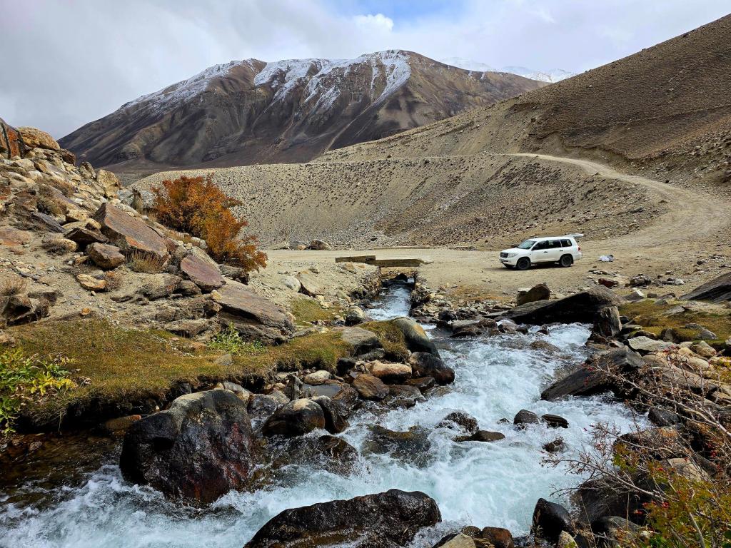
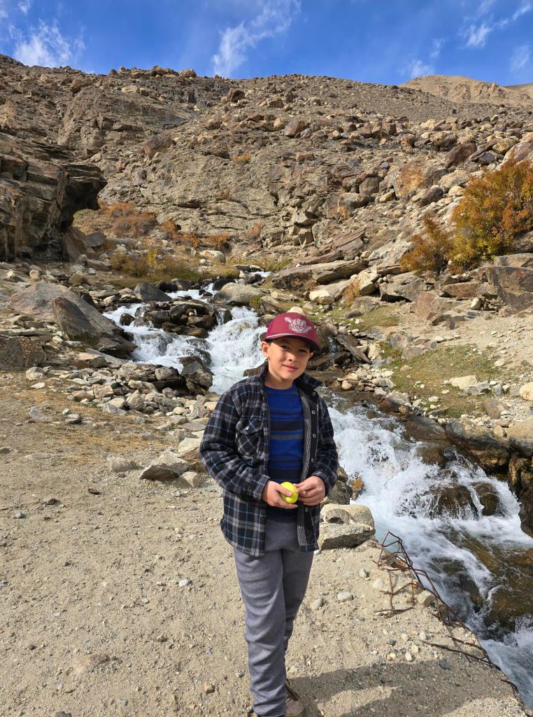
For a time, the dirt road continued to trace the border with Afghanistan. The river narrowed until, in places, it was only three or four rock-hops across. Denis told me stories of encountering caravans on the Afghan side here and tossing bags of sweets or extra food across the water. In Central Asia, it’s always wise to travel with candy, cookies, and sunflower seeds—especially for kids.
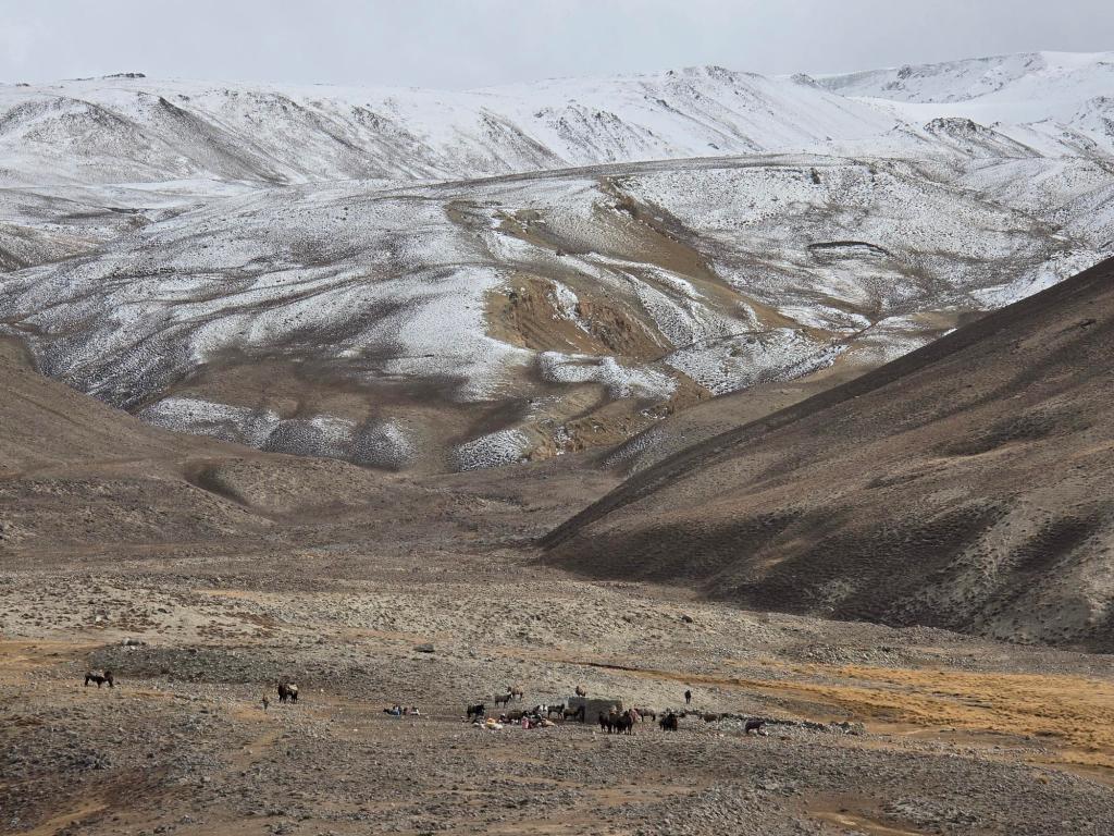
Not long after he mentioned this, we spotted our first caravan on the far side of the river, pulling up near a shelter and breaking for lunch. We’d see one more large group before our road turned away from the border and began to climb.
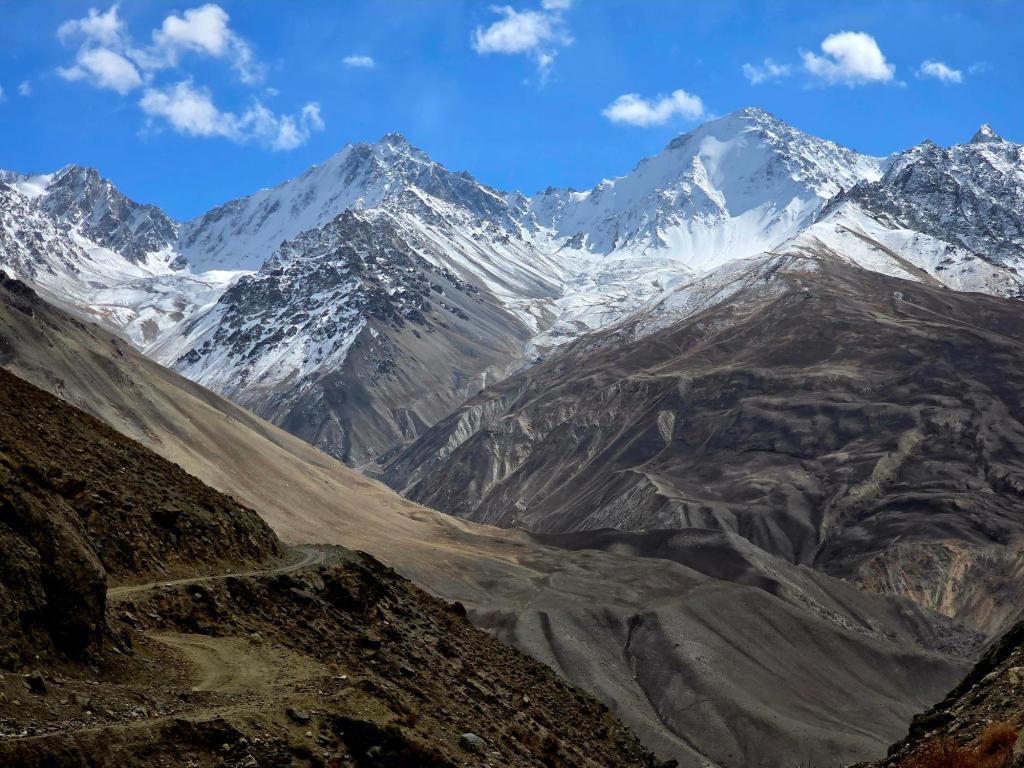
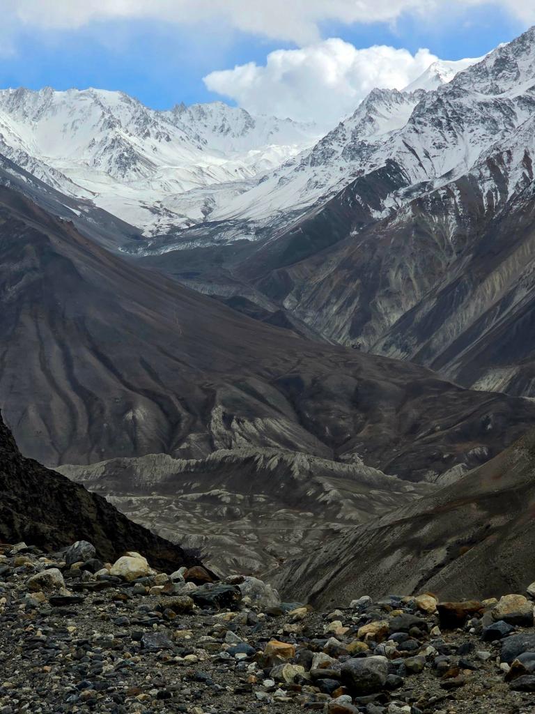
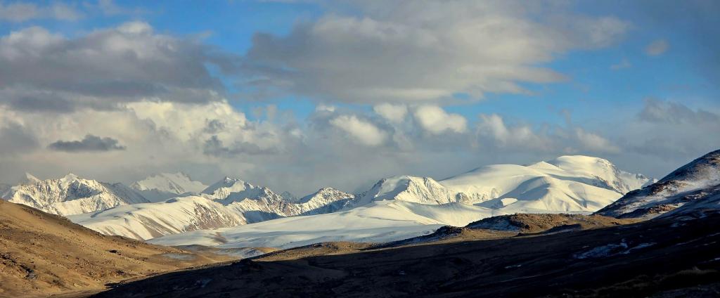
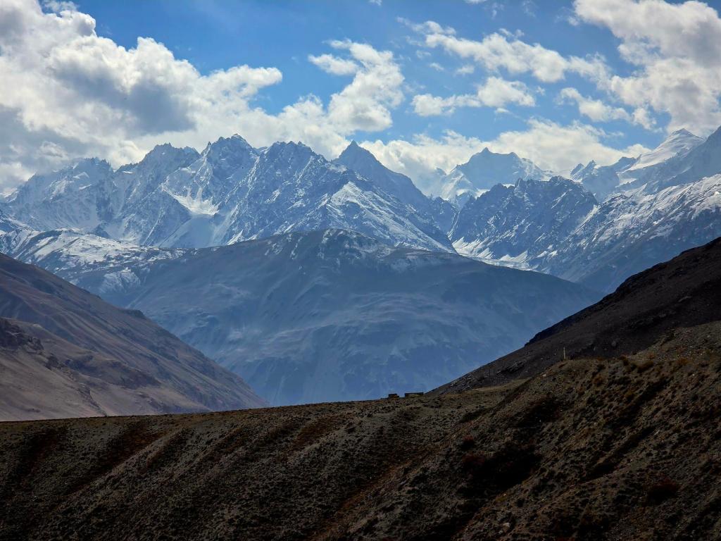
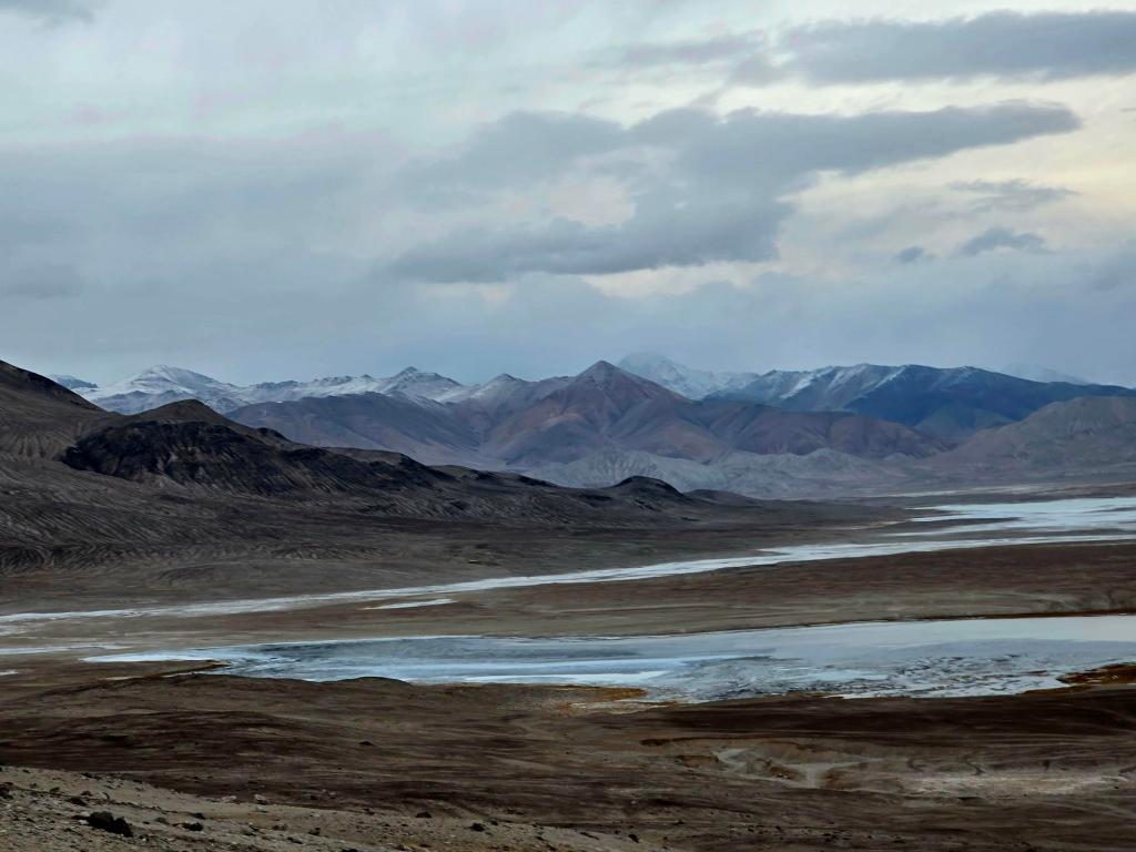
The dirt track clung to the mountainside, with occasional unnerving drop-offs. The scenery was once again staggering—wide open and severe. Distant peaks rose like stone behemoths against the empty plateau.
We crossed a small pass and dropped down beside a narrow river flowing straight out of the mountains. Pulling over, we cooked a simple lunch of ramen, instant mashed potatoes, and canned corn. While waiting for the water to boil, I wandered a bit and came across a large pile of very fresh bear scat, which quickly ended any thoughts of exploring farther up the canyon.
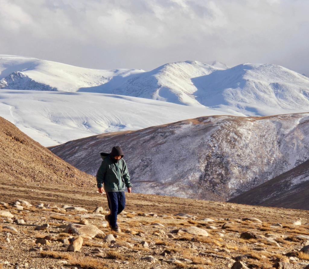
Back in the car, we continued on. Other than the caravans earlier in the day, we didn’t see another soul for nearly seven and a half hours of driving. Eventually, the road began climbing again—this time for good—winding through a stark, lunar landscape dotted with abandoned Soviet-era buildings.
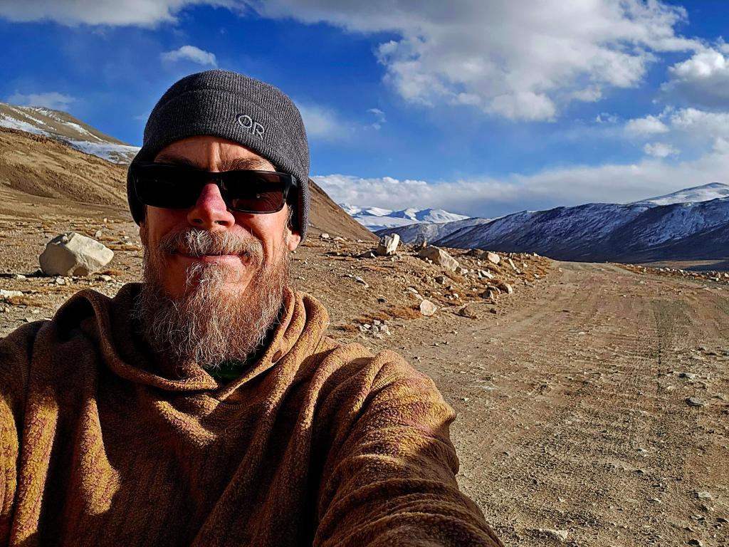
Finally, we crested Khargush Pass.
At 4,287 meters (just over 14,000 feet), it was the highest point of our trip. The air was thin and sharp. A couple of small lakes sat near the top, and we wandered briefly, snow-covered peaks rolling away into the distance like waves frozen in stone.
Descending the far side, darkness settled in. We reached pavement for the first time in hours, only to leave it again minutes later at the turnoff for Bulunkul, a high-altitude village known as the coldest permanently inhabited place in Tajikistan.
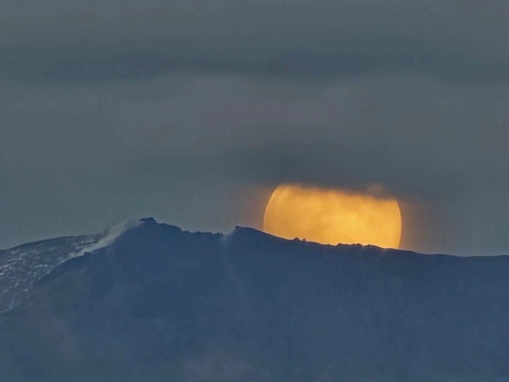
As we turned back onto dirt, a full moon rose over the mountains—huge and luminous. We pulled over and stood quietly, watching until it slipped into the clouds.
We arrived in Bulunkul to biting cold and hurried inside to meet our hosts. Their home was wonderfully warm, the wood-burning stove working overtime. Mounted on the wall was the head of a Marco Polo sheep, far larger than any skull we’d seen earlier that day, its sweeping horns almost unreal.
The bathroom sat in a small building out back, guarded enthusiastically by local dogs, while several cats lounged atop a yurt in the yard. Another hot meal followed, along with easy conversation. But the altitude and the long, demanding day caught up with us quickly.
We turned in early, knowing the high Pamirs still had plenty left to reveal.

Leave a comment