📊 Trip Stat Box — Pamir Highway (Day Five)
Route: Ishkashim → Wakhan Corridor → Langar
Driving Distance: ~140 km
Driving Time: ~6–7 hours (with stops)
Elevation Range: ~2,600 m (Ishkashim) → ~2,900 m (Langar)
Road Conditions: Dirt and rough mountain road with washboard sections
Highlights: Wakhan Corridor landscapes, Yamchun Fortress, Bibi Fatima Hot Springs, Vrang Buddhist Stupa, views of the Hindu Kush
Overnight: Homestay in Langar
Date: 10/16/2024
The Wakhan Corridor — Fortresses, Springs, and Echoes of the Silk Road
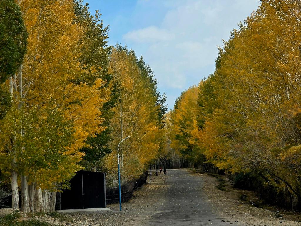
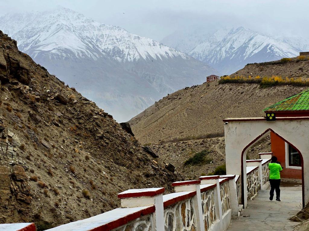
We woke early in Ishkashim to crisp mountain air and an incredible view across the river. At this point, high mountains pressed in from all sides, and from town you could already see up into the Wakhan Corridor. This is a true transitional zone—where the Pamir, Karakoram, and Hindu Kush mountain systems come together and begin to mingle.
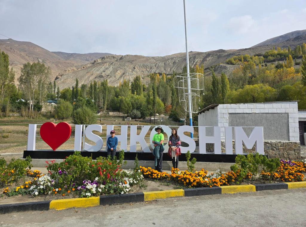
After breakfast, we walked the kilometer back into the main part of town to stock up on snacks and drinks for the day ahead. Denis stayed behind to pack the Land Cruiser and then drove in to meet us. While we were in the shop, we met a Danish couple cycling their way around the world. We stood outside chatting with them for a while, swapping stories and routes. When Denis rolled up, they climbed back onto their bikes and we into the truck, wishing each other safe travels before heading off in opposite directions—they west toward Khorog, and us east toward Langar.
Into the Wakhan
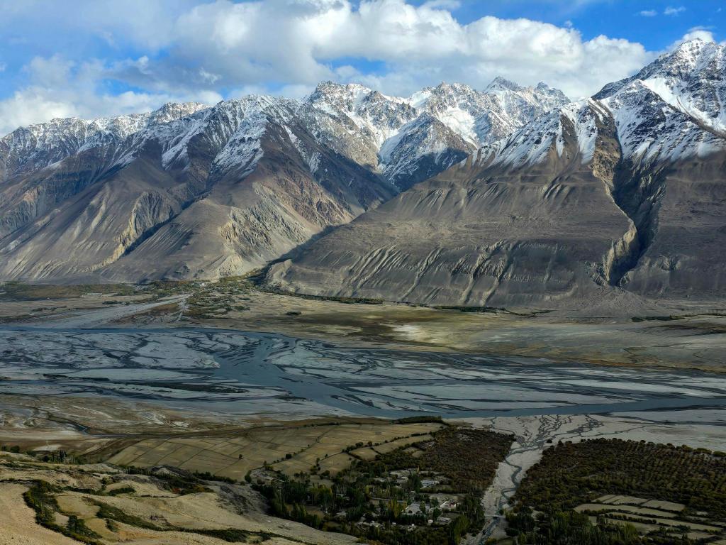
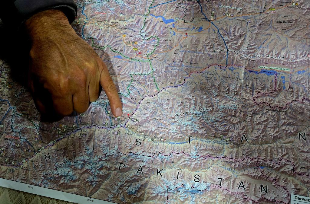
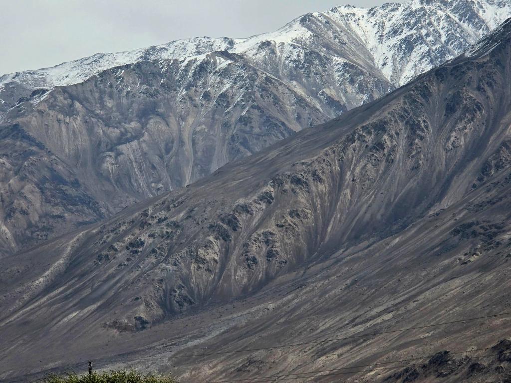
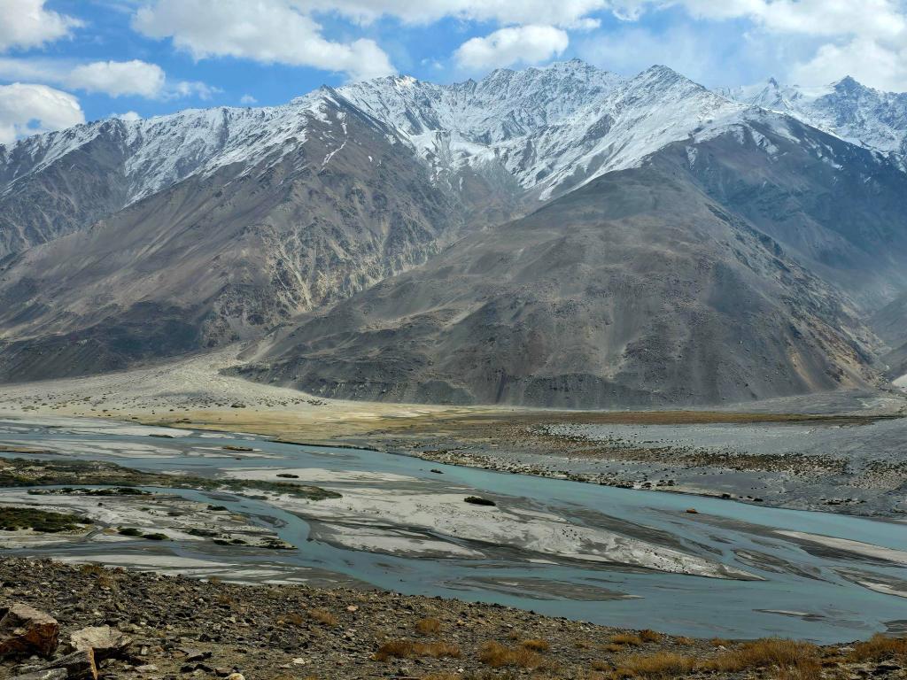
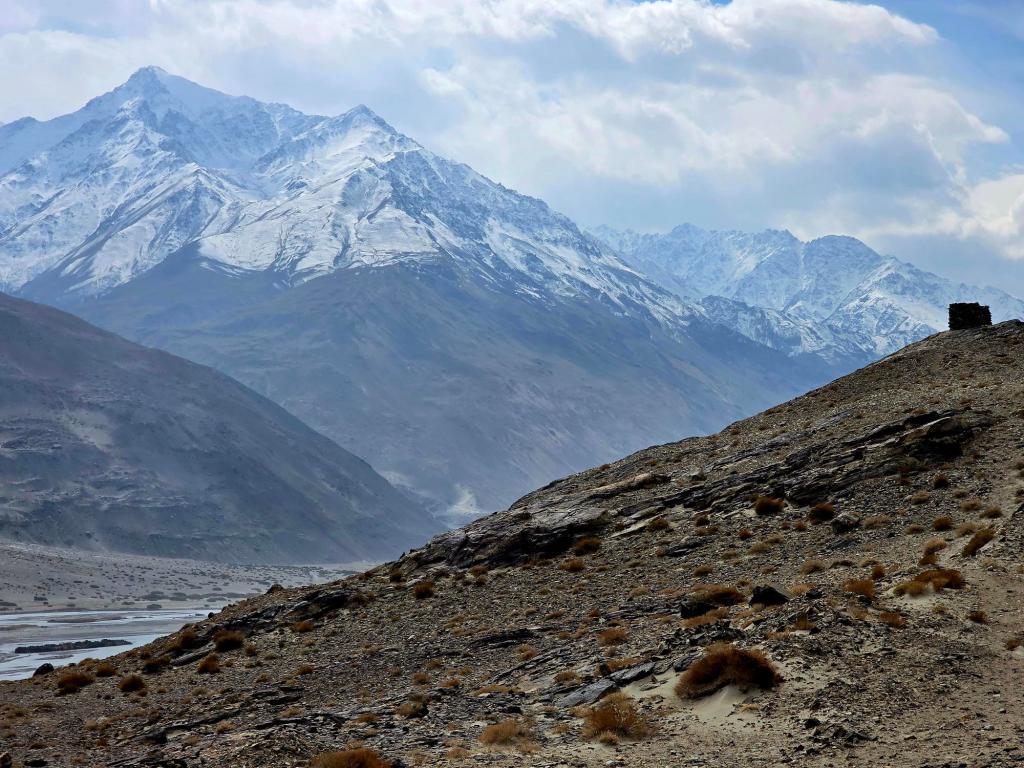
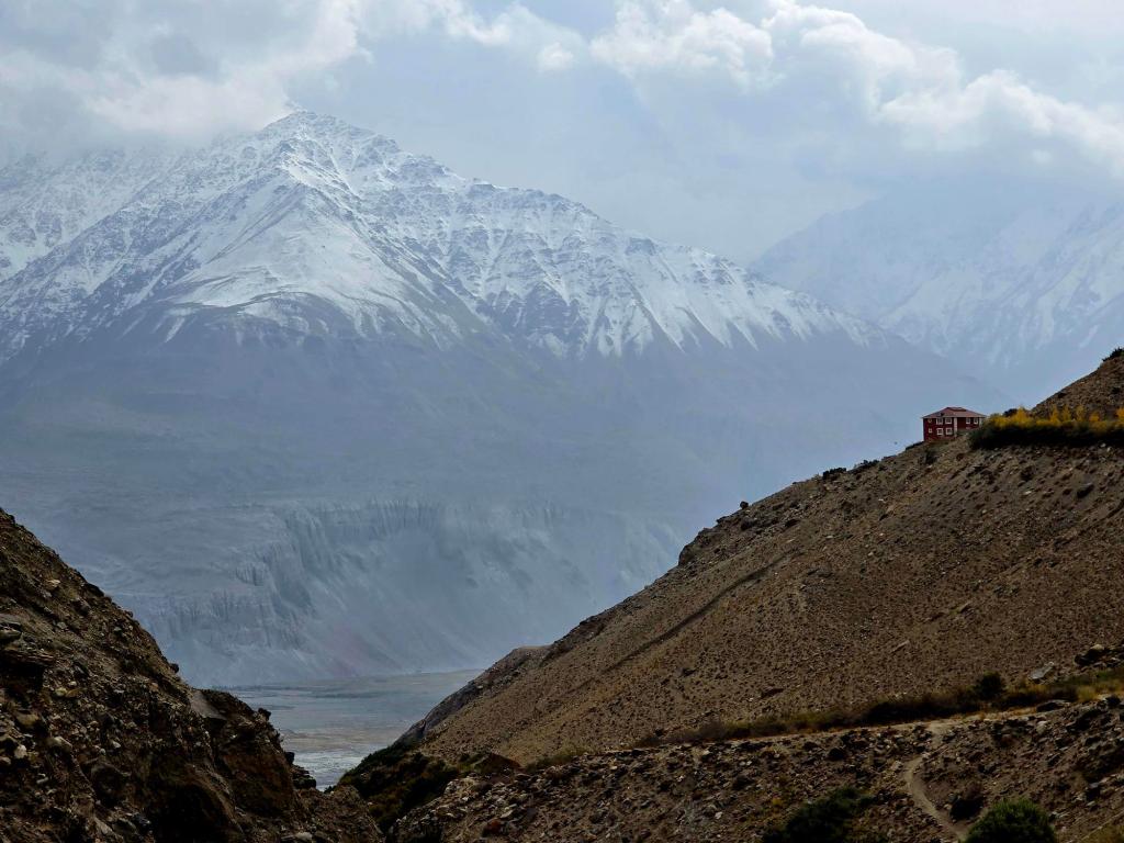
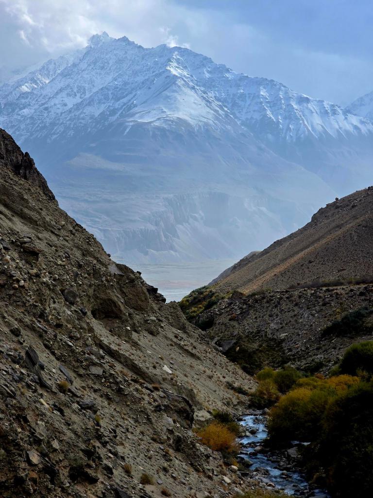
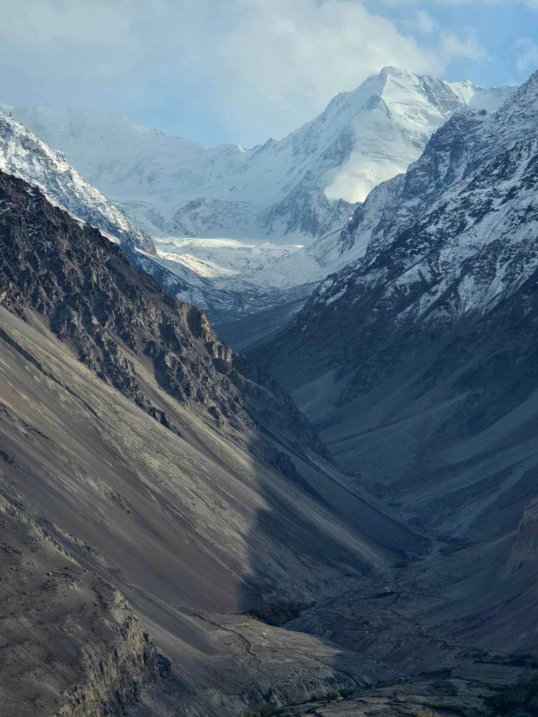
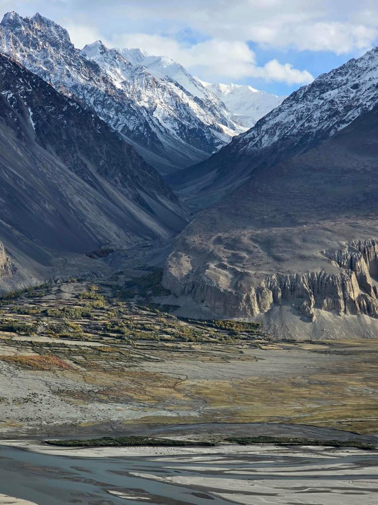
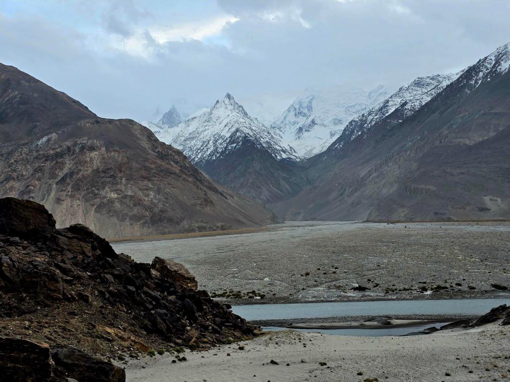
Leaving Ishkashim, we turned east into the Wakhan Corridor, a place that had been looming large in my imagination long before we ever set foot in Tajikistan. The road follows the Panj River as it threads between the Pamirs to the north and the Hindu Kush rising sharply to the south in Afghanistan. For much of the day, the river was little more than a ribbon separating two countries, with Afghan villages clearly visible across the water.
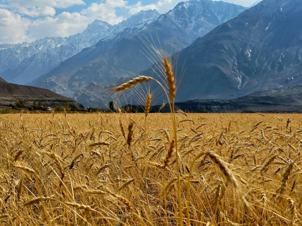
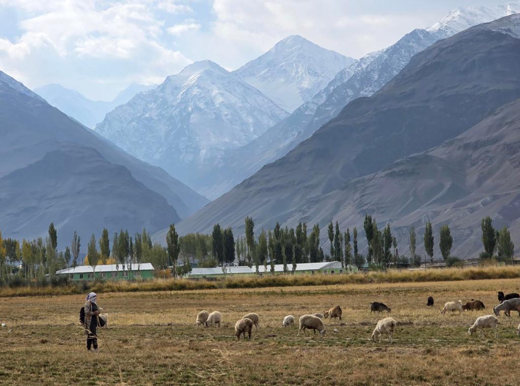
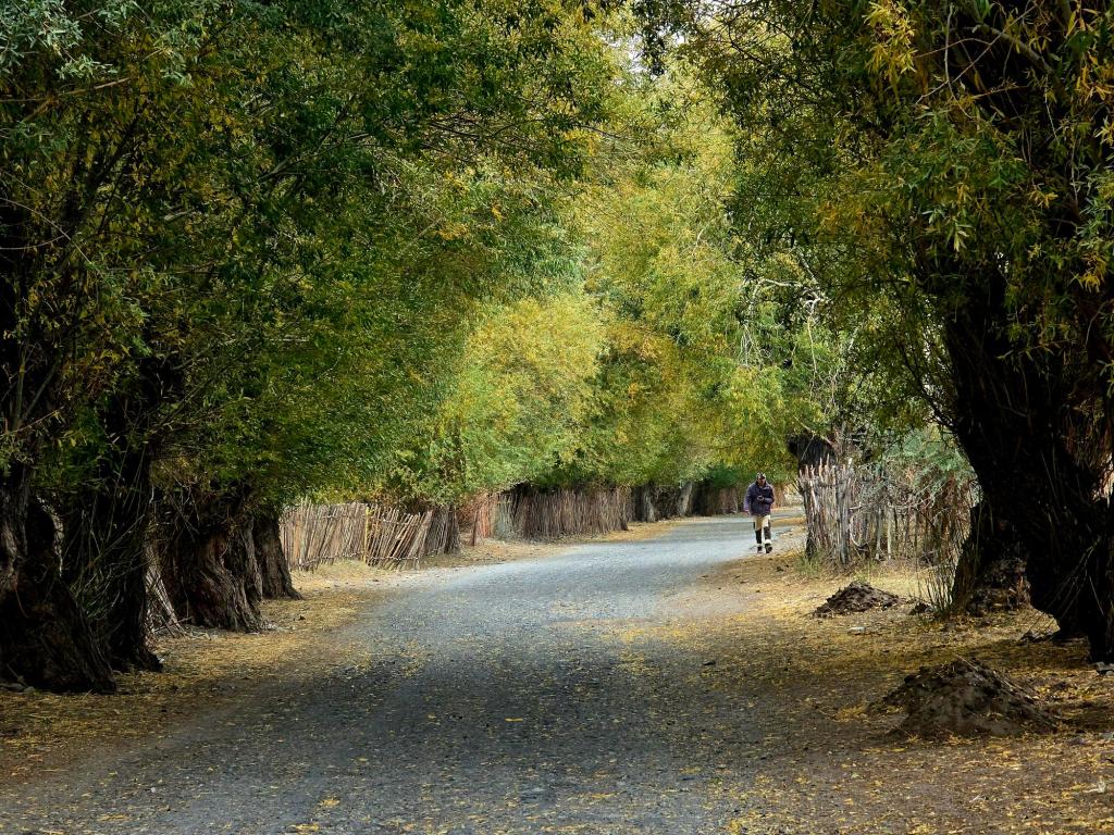
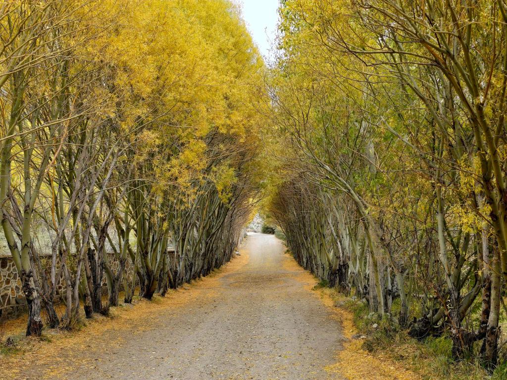
On the edge of town, we passed a woman guiding her flock of sheep, followed soon after by fields of ripening wheat. The dirt road carried us through poplar-lined avenues and sparse settlements, massive peaks rising steeply behind them. Before long, we entered the heart of the corridor, and the scale of the landscape shifted dramatically.
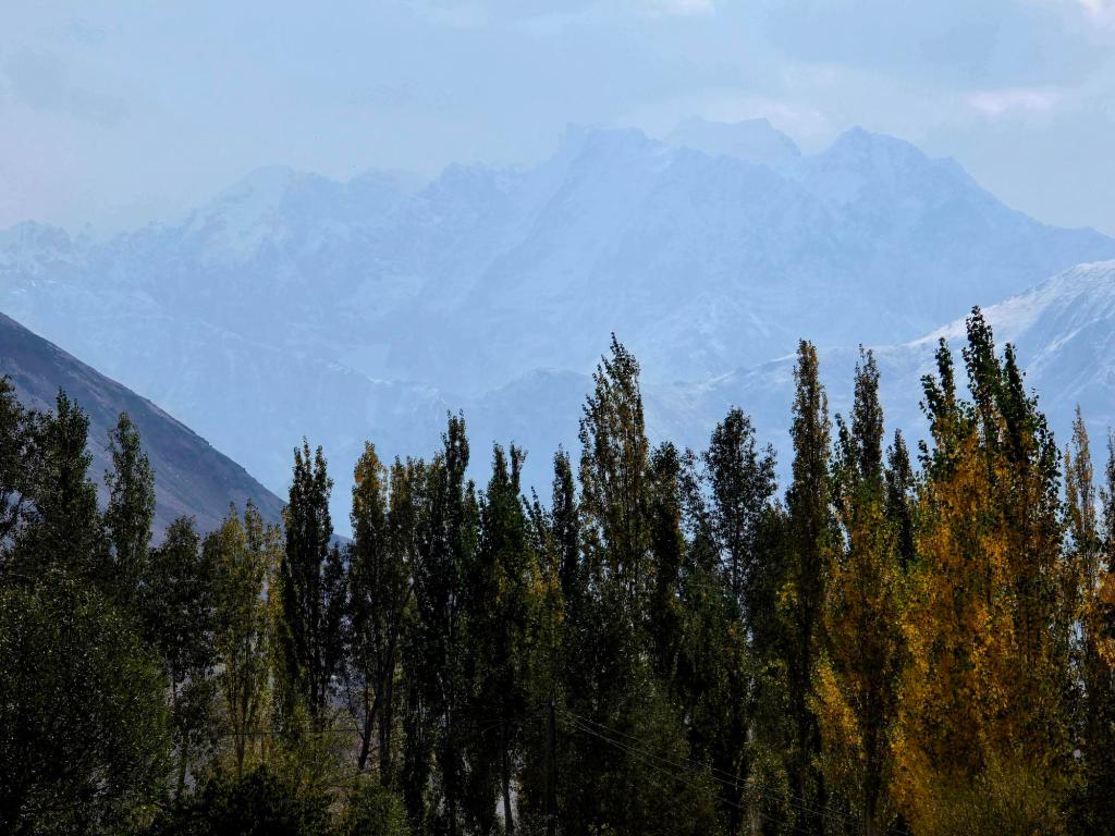
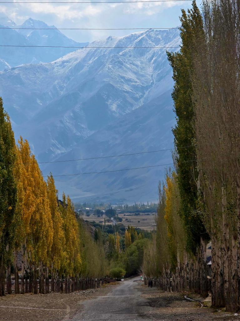
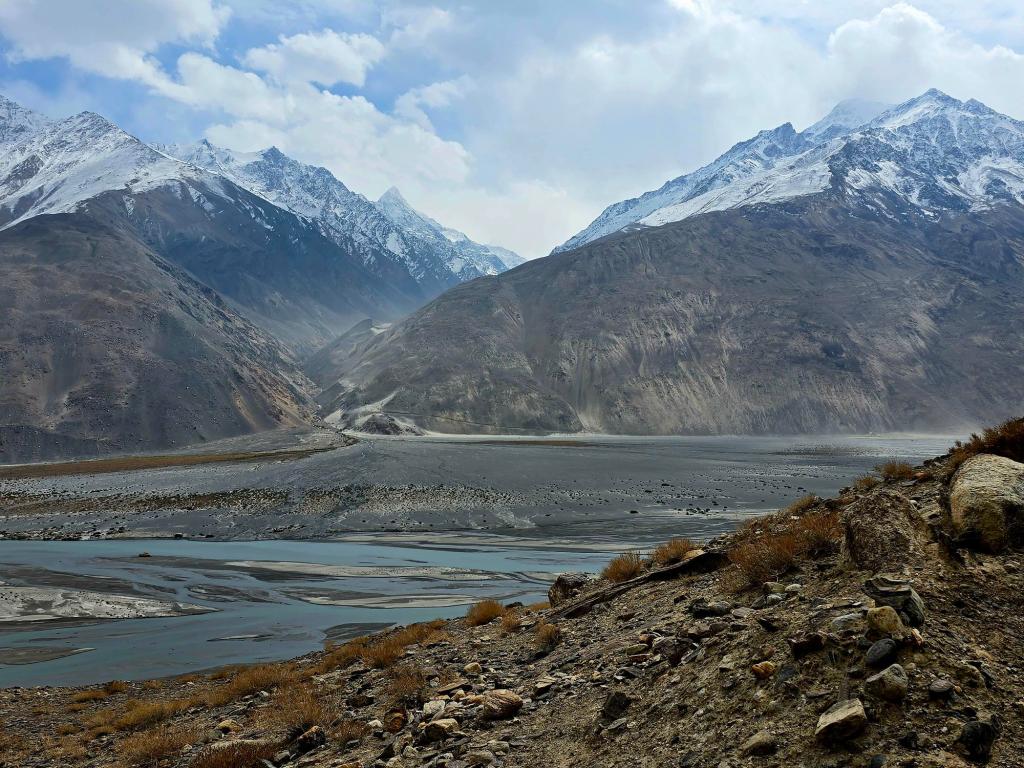
Mountains surged straight up from the valley floor, their upper reaches lost in light and cloud. The Panj broke into countless channels and silver ribbons stretching far down the valley. Wind tore through the corridor, pushing dust clouds along the flats. It felt like a place where that wind might never truly stop—though with only a single day here, I can’t confirm that theory.
We stopped every ten minutes or so just to step out of the vehicle and take it all in. There wasn’t another car in sight. The road ran straight into the distance before disappearing behind a far-off ridge. It felt less like Central Asia and more like another planet entirely.
Yamchun Fortress & Bibi Fatima
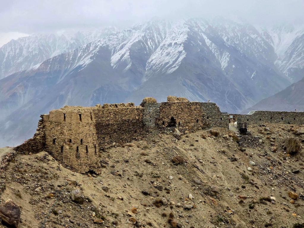
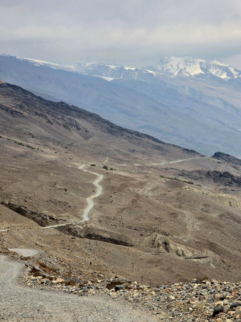
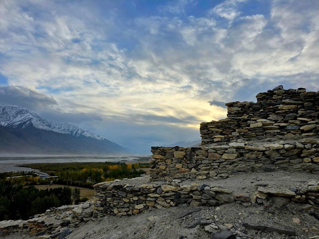
Eventually, we reached the sign pointing toward Yamchun Fortress and Bibi Fatima Hot Springs. The side road immediately pitched upward, switchbacking steeply as we climbed higher and higher above the valley. Then, rounding a corner, Yamchun appeared—perched on its ridge in all its ancient glory.
Built long before the arrival of Islam, Yamchun Fortress dates back more than 2,000 years, likely to the Kushan Empire period, when it guarded a key stretch of the Silk Road and protected the local principality. Much of the original stonework is still visible today, though active restoration is underway. When we visited, a large team was at work, and it seems only a matter of time before the site is fully restored.
We drove past the fortress first and continued uphill to Bibi Fatima Hot Springs. The springs are remarkable—clear, mineral-rich water bubbling straight out of the rock at about 105°F (41°C). You can soak in an open-air pool carved into the cliff face or choose one of the private cave-like chambers where warm water flows beneath you and the rock presses in overhead.
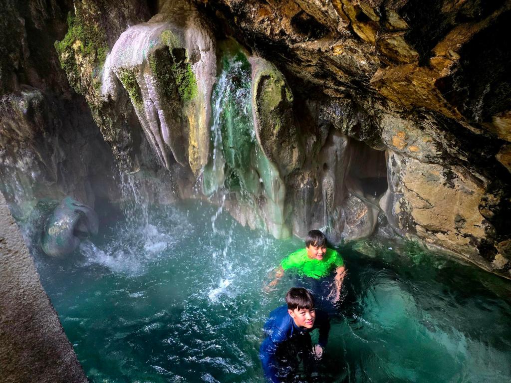
We waited our turn while a local woman and her daughter finished bathing. My wife and daughter went first, followed by the boys and me, keeping our soak to around fifteen minutes. Locals believe the waters have healing properties and fertility-enhancing benefits, and like other hot springs in the region, they release small amounts of radon gas, making short soaks advisable.
Just down the road, we stopped for lunch at a small restaurant, filling up on plates of potatoes and hearty meat soup before heading back down toward the fortress.
Yamchun — Above the Wind
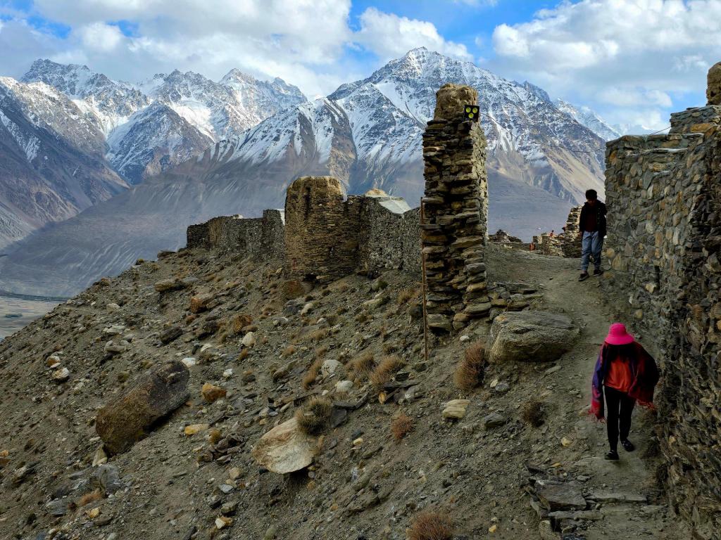
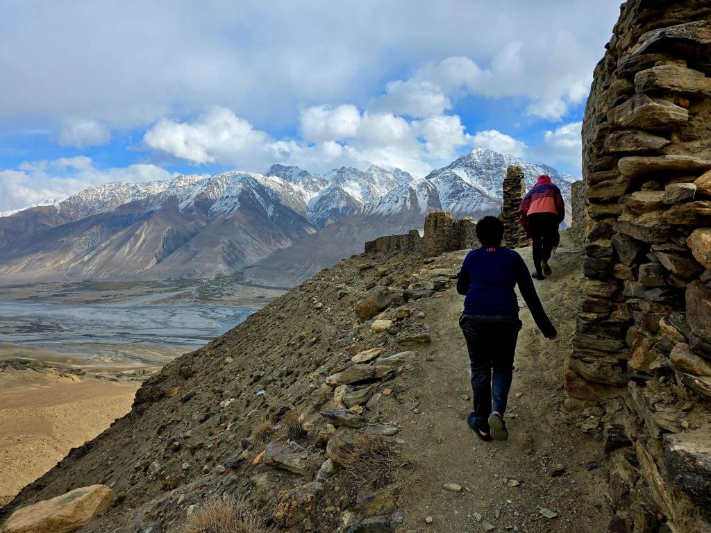
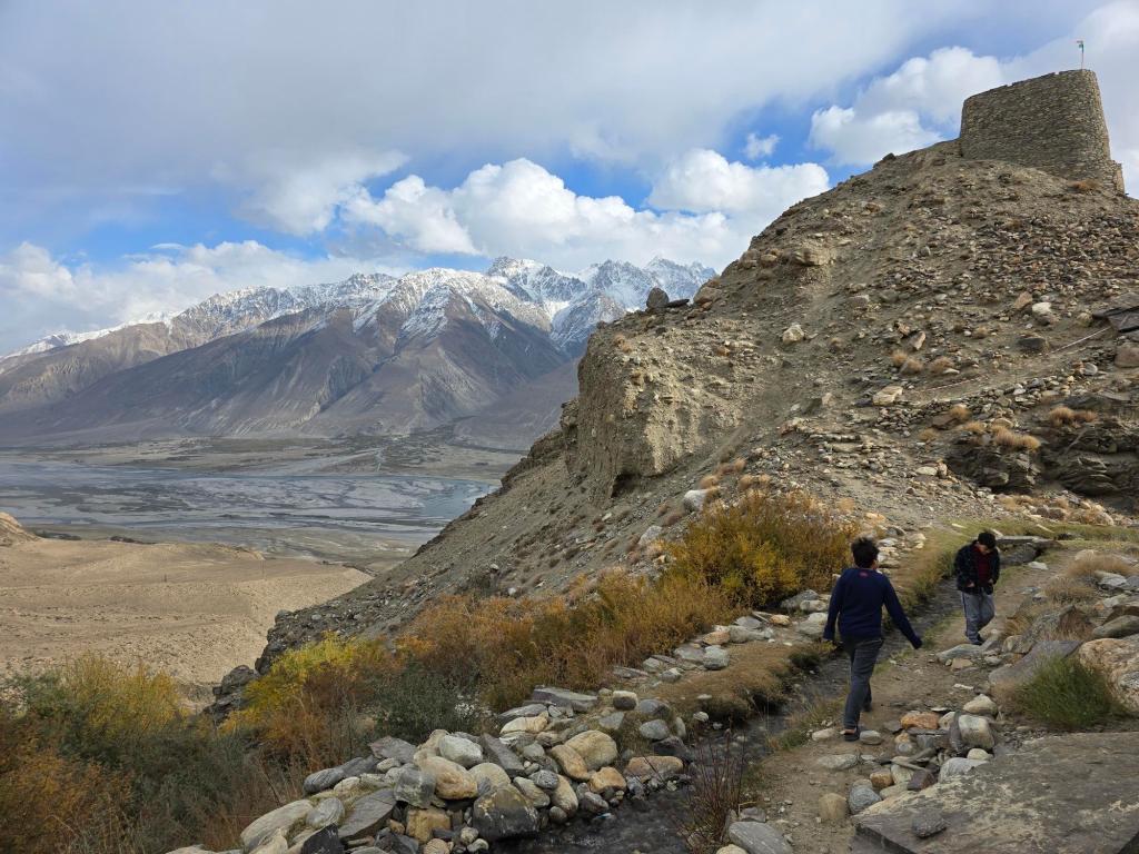

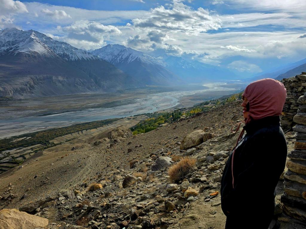
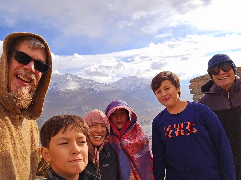
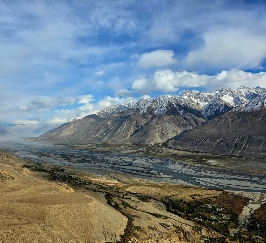
Approaching Yamchun on foot, the fortress reveals itself gradually. As you reach the edge closest to the valley, the view opens in a way that’s almost overwhelming. The entire Wakhan Corridor spreads out below, silent except for the relentless wind. The Panj lies far beneath, split into countless branches too distant to make much sound. High above, eagles circled endlessly on rising thermals.
The feeling here is intense. There’s awe, certainly—but also something darker and more primal. Mountains this vast and remote stir both admiration and unease. There’s a hint of Mordor in the atmosphere, a reminder that this landscape is as unforgiving as it is beautiful. Life in a place like this produces people who are hardy, resilient, and deeply self-sufficient.
🏔️ A Note on the Name “Hindu Kush”
One of the stories we’d heard along the road involved the name Hindu Kush itself — that it came from an ancient military blunder in which an army was led deep into these mountains and left stranded. That specific tale, while vivid, isn’t supported by historical evidence. The most widely cited origin for the name comes from medieval Persian and Arabic accounts: the traveler Ibn Battuta recorded the name Hindu Kush (often translated as “Indian-killer”) in the 14th century, describing how people being taken from the Indian subcontinent as slaves sometimes perished in the harsh high-mountain passes. This grim explanation is echoed in traditional sources and dictionaries of the region, even as some linguists argue the name may originally have meant something closer to “mountains of India/Indus” or be linked to older regional terms. In any case, the name reflects just how unforgiving these high passes have been throughout history for those who attempted to cross them.
Vrang & the Buddhist Past
Farther east, we reached the village of Vrang and pulled over beside a small sign reading “Buddhist Site.” We crossed a field while dogs barked from nearby yards, then climbed roughly 70–80 meters up a trail that leveled out along a shelf cut into the hillside.
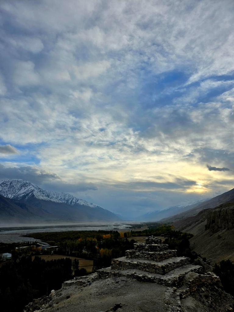
There, overlooking the valley, stood a Buddhist stupa—one of the last remaining in Tajikistan. Though its exact age isn’t known, it dates back many centuries and stands as a quiet reminder that Buddhism once flourished here, alongside earlier Zoroastrian beliefs and later Islam. A large reclining Buddha once stood nearby as well, but it has since been moved to a museum in Dushanbe.
The stupa offers sweeping views over the Wakhan Valley and surrounding peaks. Locals also speak of caves in the nearby cliffs that may have served as monk cells during the Buddhist period. Travelers sometimes hear stories of “Chinese writing” in these caves, likely tied to accounts by the 7th-century Chinese pilgrim Xuanzang, who described monasteries in Wakhan. Researchers, however, have documented ancient inscriptions here in scripts such as Old Tibetan, rather than Chinese characters.
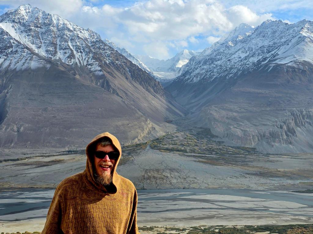
Langar at Dusk
We rolled into Langar as the sun slipped behind the peaks, dust still hanging in the air from the road. The day had been dense with scenery, history, and sheer scale—one of those days that takes time to fully process.
As evening settled in, it was clear the Wakhan had delivered on everything it promised: raw beauty, deep history, and the unmistakable feeling of standing at a crossroads of civilizations.

Leave a comment