📍 One of the Best Day Hikes Near Dushanbe
Distance: 10–12 miles round trip (depending on turnaround)
Elevation Gain: ~2,000 ft / ~600 m
Time on Trail: 5–6 hours
Difficulty: Easy–Moderate
Best Season: Spring–Fall
Water: River access (filter recommended)
Kid Friendly: Yes (with supervision)
I remember reading about the 7-Bridges Hike in the months leading up to our move to Tajikistan. It came up again and again—often described as the go-to hike near Dushanbe. After finally hiking it ourselves, it was easy to see why.
The trail strikes that perfect balance: a gradual incline that works well for younger kids, paired with enough distance and elevation gain to still feel like a solid day out in the mountains. We first hiked this trail on September 9th, 2024, and have returned a handful of times since—including a couple of relaxed overnighters that reminded us just how much more there is to explore beyond the standard day hike.
Getting There
The trail is easy to access from Dushanbe, taking about 40 minutes by car from the city center.
Heading north out of the city, turn right in the village of Varzob, not far past The Pearl of Tajikistan sign and just before the local grocery market. From there, follow the road about 5 km to its end, where you’ll usually find a few other vehicles parked in a small dirt lot.
If you arrive in Varzob by marshrutka, it’s worth hopping in a taxi for the final stretch. Walking the road adds distance and dust, and you’ll pass plenty of summer homes—with village dogs roaming about to make things… lively.
Onto the Trail
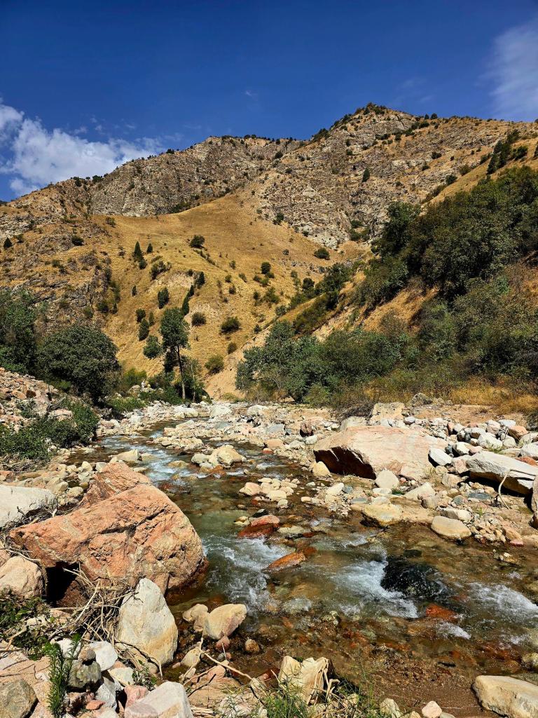
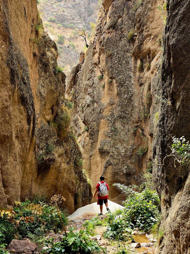
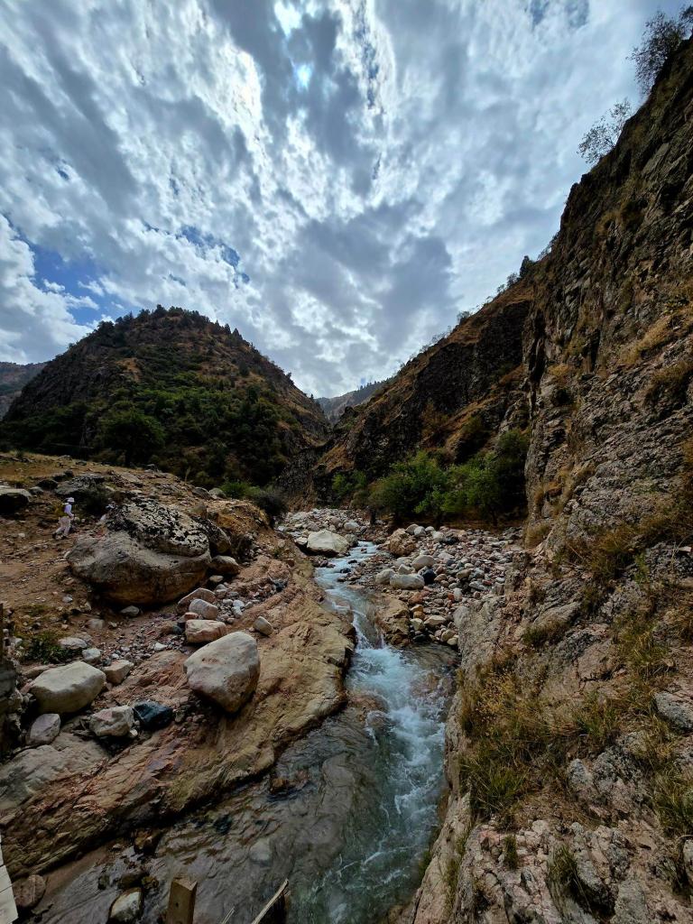
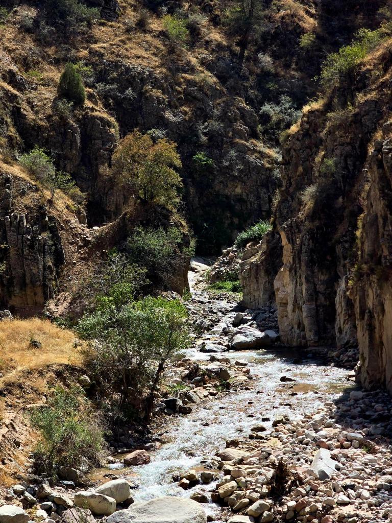
From the parking lot, you’ll cross the first bridge almost immediately, and the hike begins with a gentle ascent into the Ojuk River valley—one of the tributaries feeding into the roaring Varzob River below.
The trail stays close to the water and slowly gains elevation, making it easy to settle into a steady rhythm. It’s lush, green, and surprisingly peaceful considering how close you are to the city.
Waterfalls, Tadpoles, and First Sightings
At the second bridge, keep an eye out for a trail breaking off to the left. A quick 5–10 minute scramble up a narrow mini-canyon leads to a beautiful waterfall with a shallow pool at its base.
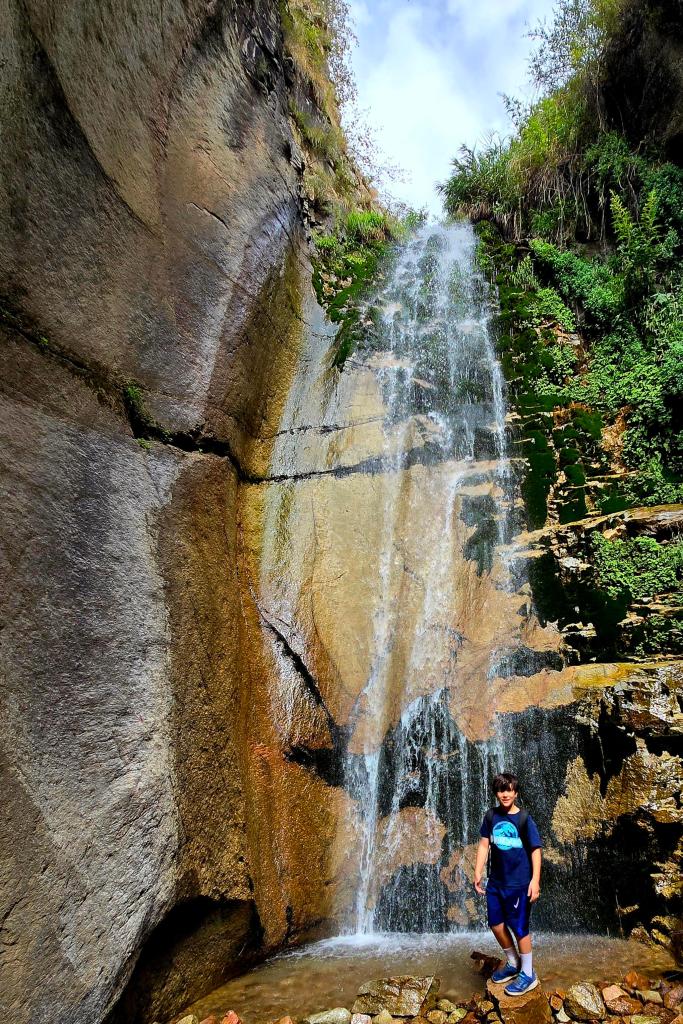
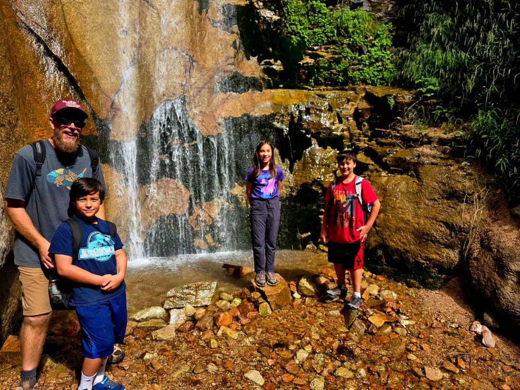
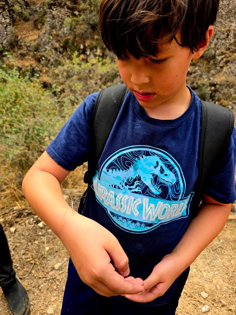
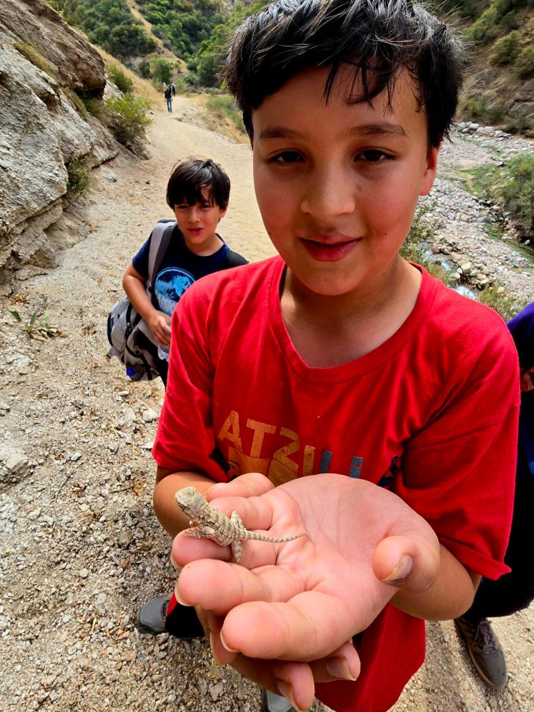
In September, this area was absolutely crawling with tadpoles, which instantly won over our bug-, reptile-, and amphibian-loving kids. Up to this point, their only complaint about hiking in Tajikistan had been the lack of “cool creatures.”
That complaint officially ended here.
Not long after the second bridge, they spotted a juvenile Caucasian rock agama, followed soon after by an absolutely incredible cone-headed mantis—the first we’d ever seen in person, and also a walking stick bug. From that moment on, the 7-Bridges Hike earned a permanent spot in our family rotation.

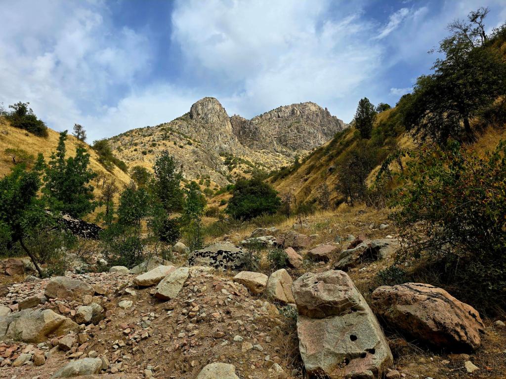
Crossing Bridges and Going Deeper
When you reach the fifth bridge, there’s another short side trail that drops down to a smaller waterfall—worth a quick detour if you’ve got the time.
Continue onward, eventually passing the seventh bridge, and walk another couple hundred meters to reach an excellent picnic spot right on the river. This is a great turnaround point for a day hike, especially with kids.
Camping & Overnight Options
If you’re looking to turn this into an overnighter, keep hiking another 1–1.5 miles until the trail reaches a fork in the river. Here you’ll find several beautifully shaded campsites right along the water.
There are small pools nearby, perfect for an invigorating dip after a long day on the trail. It’s a quiet, peaceful place to spend the night—and a great base for exploring further.
From this first camping area, multiple trails continue in different directions, and with some planning, you can turn this hike into a multi-day backpacking route toward Romit, Dara, or even farther east along routes that clearly see very little foot traffic.
Final Thoughts
The 7-Bridges Hike is one of the best ways to spend a full day outside the city—wandering through a lush river valley, taking in mountain views, and slowly working your way deeper into the valley.
Expect 5–6 hours on the trail to cover the full 10–12 miles, with just under 2,000 feet of elevation gain. On the return hike, you’ll be treated to great views back toward the mountains in the Gissar Range, and that familiar feeling of not quite being ready to head back into town just yet.
Bring plenty of water, sunscreen, and time to explore. This is a trail that rewards those who don’t rush it.

Leave a comment